Search the Special Collections and Archives Portal
Search Results
Simulated Eddects of Proposed Ground-water Pumping in 17 Basins of East-Central and Southern Nevada; U.S. Geological Survey - Water-Resources Investigations Report 95-4173 by Schaefer, Donald H. & Harrill, James R., 1995
Level of Description
File
Archival Collection
Clark County Planning Commission Research Library Collection
To request this item in person:
Collection Number: MS-01027
Collection Name: Clark County Planning Commission Research Library Collection
Box/Folder: Box 73
Collection Name: Clark County Planning Commission Research Library Collection
Box/Folder: Box 73
Archival Component
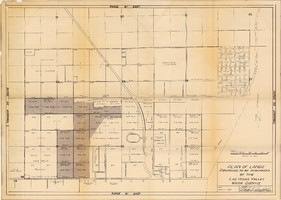
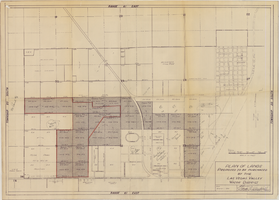

Map showing possible industrial users' connections to railroad pipelines in Las Vegas, Nevada, December 4, 1930
Date
1930-12-04
Archival Collection
Description
Stamped portion near lower right corner reads 'Union Pacific System, L.A. & S.L. R.R. Scale: 1" = 100'. Date: 12-4-30. Office Division, Eng'r. Los Angeles. Drg. No. 916.' 10 3/4 in. x 33 3/4 in. Scale: 1" = 100"..
Image
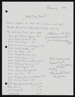
Alpha Kappa Alpha Sorority, Theta Theta Omega Chapter "Water Day" report
Date
1992-02
Archival Collection
Description
From the Alpha Kappa Alpha Sorority, Incorporated, Theta Theta Omega Chapter Records (MS-01014) -- Chapter records file.
Text
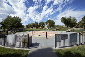
A water play area in the Justice Myron E. Leavitt & Jaycee Community Park, Las Vegas, Nevada: digital photograph
Date
2017-09-13
Archival Collection
Description
An idle water play area in the Justice Myron E. Leavitt & Jaycee Community Park off South Eastern Avenue north of East Sahara Avenue. The park is 18-acres and named after Justice Myron E. Leavitt, who was born in Las Vegas in 1930 and lived in the Jaycee Park area his entire life.
Image
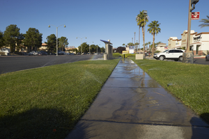
Grass watering along West Sahara Avenue at Fort Apache Road, looking west, Las Vegas, Nevada: digital photograph
Date
2017-10-10
Archival Collection
Description
Sprinklers irrigate grass at the Village Square commercial center on the northwest corner of West Sahara Avenue and Fort Apache Road.
Image
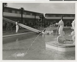
Photographs and documents promoting the "Water Wake-Up Service" at the Dunes Hotel, Las Vegas, circa November 1955
Date
1955-11
Archival Collection
Description
A series of photographs and documents that outline the promotional event the "Water Wake-Up Service" at the Dunes Hotel. The notes and correspondence pertain to the formation of the event, including correspondence to news agencies asked to cover the event.
Mixed Content
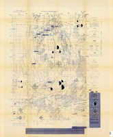
Map of the Nevada Test Site and vicinity showing principal rock types and chemistry of ground water, 1964
Date
1964
Description
'Compiled by S.L. Schoff and J.E. Moore.' 'Geology generalized from geologic maps of the Nevada Test Site by Special Projects Branch, U.S. Geological Survey; of Lincoln County by Tschanz and Pampeyan (1961); and of Clark County by Bowyer, Pampeyan, and Longwell (1958).' United States Department of the Interior, Geological Survey. Prepared in cooperation with the U.S. Atomic Energy Commission.' 'TEI-838.' Scale 1:125,000 (W 116°00´--W 116°15´/N 37°15´--N 36°30´). Originally published as figure 1 in Chemistry and movement of ground water, Nevada Test Site / by Stuart L. Schoff and John E. Moore, published by the Geological Survey in 1964 as number 838 of the Trace elements investigations report.
Image
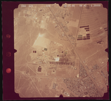
Aerial photograph of North Water Street, Boulder Highway, Lake Mead, and Sunset Road, Henderson (Nev.), June 5, 1980
Date
1991-05-06
Archival Collection
Description
Photograph of the desert and the streets North Water Street, Boulder Highway, Lake Mead Parkway, Sunset Road and also what is now Highway 15.
Image
Pagination
Refine my results
Content Type
Creator or Contributor
Subject
Archival Collection
Digital Project
Resource Type
Year
Material Type
Place
Language
Records Classification
