Search the Special Collections and Archives Portal
Search Results
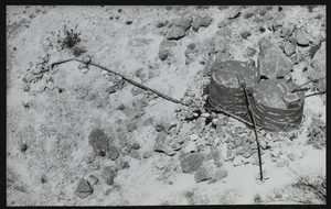
Artificial watering device for desert bighorn sheep in the Muddy Mountains of Clark County, Nevada: photographic print
Date
1900 (year approximate) to 1999 (year approximate)
Archival Collection
Description
From the UNLV Libraries Single Item Accession Photograph Collection (PH-00171). Constructed by the Fraternity of the Desert Bighorn, a Las Vegas based conservation and sportsman's club.
Image
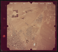
Aerial photograph of North Water Street, Boulder Highway, and Lake Mead, Henderson (Nev.), June 5, 1980
Date
1991-05-06
Archival Collection
Description
Photograph of the desert and the streets North Water Street, Boulder Highway, Lake Mead Parkway, & also what is now Warm Springs.
Image
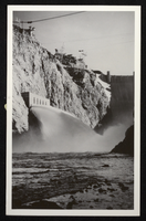
Postcard showing water discharging from jet flow gates, Hoover Dam, circa 1935-1936
Date
1935 to 1936
Archival Collection
Description
An image of Boulder Dam with open jet flow gates (outlet works). The name was officially changed to Hoover Dam in 1947.
Image
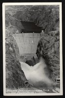
Postcard showing water discharging from jet flow gates, Hoover Dam, circa 1935-1936
Date
1935 to 1936
Archival Collection
Description
An image of Boulder Dam with open jet flow gates (outlet works). The name was officially changed to Hoover Dam in 1947.
Image
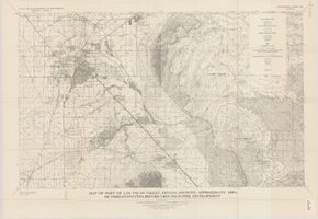
Map of part of Las Vegas Valley, Nevada, showing approximate area of phreatophytes before ground-water development
Date
1965
Description
Genre/Form: Thematic maps. Scale 1:62,500 (W 115°15´--W 114°45´/N 36°15´--N 36°00´). 1 map : col. ; 44 x 72 cm. Series: Water-supply paper (Washington, D.C.) ; 1780. Relief shown by contours. Originally published as plate 10 of Available water supply of the Las Vegas ground-water basin, Nevada, by Glenn T. Malmberg, published by the Geological Survey in 1965 as its Water-supply paper 1780. Includes township and range lines. Interior, Geological Survey
Image
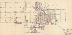
Map showing facilities of the Las Vegas Land and Water Co. completed, under construction and commenced after September 1, 1952
Date
1953-04-29
Description
'Exhibit D. Facilities of Water Company completed as of September 1, 1952. Facilities of Water Company under construction as of September 1, 1952. Facilities of Water Company which were commenced after September 1, 1952, and prior to March 1, 1954. April 29, 1953. I-67.'
Image
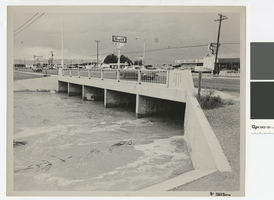
Photograph of water running high in flood channel and North Las Vegas Boulevard flood channel
Date
1970 (year approximate)
Archival Collection
Description
Flood channel with water running high under North Las Vegas Boulevard. Signs on front for 91 and 93 freeways
Transcribed Notes: Notes from photo sleeve: "Las Vegas Boulevard North and North Las Vegas flood channel, ca. 1970s." Notes on back: "Las Vegas Blvd North and NLV flood channel."
Image
Trend Analysis of Ground-Water Levels and Spring Discharge in the Yucca Mountain Region, Nevada and California, 1960-2000 - U.S. Geological Survey, Water-Resources Investigations Report 02-4178, 2002
Level of Description
File
Archival Collection
Yucca Mountain Environmental Safety Reports Collection
To request this item in person:
Collection Number: MS-00786
Collection Name: Yucca Mountain Environmental Safety Reports Collection
Box/Folder: Box 36
Collection Name: Yucca Mountain Environmental Safety Reports Collection
Box/Folder: Box 36
Archival Component
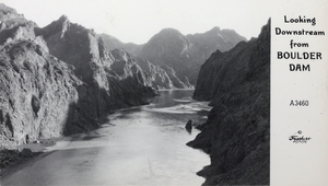
Postcard showing downstream water flow at Hoover Dam, circa late 1930s
Date
1935 to 1939
Archival Collection
Description
A postcard with the description "Looking downstream from Boulder Dam" printed on it. The name was officially changed to Hoover Dam in 1947.
Image
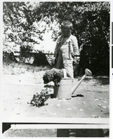
Photograph of a young Indian boy with a puppy in a watering can, Pahrump Valley, Nevada, circa 1880s-1890s
Date
1880 to 1899
Archival Collection
Description
An unidentified young Indian boy with a puppy in a watering can. The photograph was most likely taken at Manse Ranch. This is the same boy as in Image ID: 0096 0006.
Image
Pagination
Refine my results
Content Type
Creator or Contributor
Subject
Archival Collection
Digital Project
Resource Type
Year
Material Type
Place
Language
Records Classification
