Search Results

People make their way through the water spray caused by overflow water in the Arizona spillway, looking west at Hoover Dam, Arizona: photographic slide
Date
1983-08
Archival Collection
Description
This series of photographs documents the historic water overflow at Hoover Dam as seen from the Arizona side of the dam. Taken in August of 1983, this overflow marked the first time the spillways were used during a flood. After initially being filled, the spillways were tested once in August of 1941.
Image
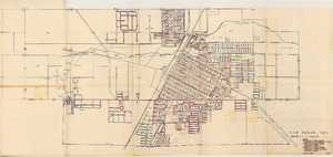
Map showing various facilities of the Las Vegas Land and Water Company, March 1, 1953
Date
1953-03-01
Archival Collection
Description
'Exhibit C.' 'March 1, 1953.' 'I-67.' Scale [ca. 1:7,200] 1 in.=600 feet. Map shows facilities [mainly water-pipes] of Las Vegas Land and Water Company completed and those under construction as of September 1, 1952, and facilities which were commenced after September 1, 1952, and prior to March 1, 1953. Map made as part of the papers for the sale of Las Vegas Land and Water Company facilities to the Las Vegas Valley Water District. Shows township and range lines. Library's copy has hand-written notes in pencil. Las Vegas Land and Water Company?
Image
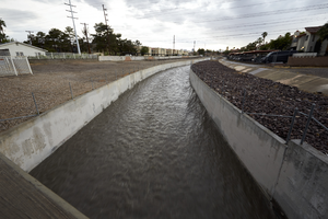
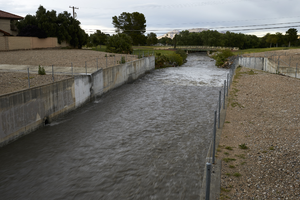
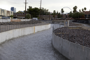
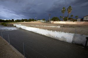
Tropicana Wash flood water, Las Vegas, Nevada: digital photograph
Date
2016-04-28
Archival Collection
Description
Water flows down Tropicana Wash at Spencer Street after an afternoon storm.
Image
Tropicana Wash flood water, Las Vegas, Nevada: digital photograph
Date
2016-04-28
Archival Collection
Description
Water flows down Tropicana Wash at Spencer Street after an afternoon storm.
Image
Tropicana Wash flood water, Las Vegas, Nevada: digital photograph
Date
2016-04-28
Archival Collection
Description
Water flows down Tropicana Wash at Spencer Street after an afternoon storm.
Image
Tropicana Wash flood water, Las Vegas, Nevada: digital photograph
Date
2016-04-28
Archival Collection
Description
Water flows down Tropicana Wash at Spencer Street after an afternoon storm.
Image

Las Vegas, Nevada - sale of water to lessees in industrial districts (2 of 2)
Date
1929 to 1957
Archival Collection
Description
Series 2. Las Vegas Land and Water Company -- General Manager, Manager of Properties, and Manager of Industrial Development in Los Angeles, California -- Industrial Development Subject Files
Text