Search the Special Collections and Archives Portal
Search Results
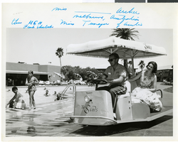
Photograph of Miss Archer at the Sands Hotel, Las Vegas, circa 1958-1959
Date
1958 to 1959
Archival Collection
Description
Miss Archer at the Sands Hotel and Casino in Las Vegas, Nevada. Miss Archer, from Melbourne, Australia, was winner of the Miss Teenager [Australia ?] and is pictured in the Sands mobile near the Sands pool. She was at the hotel with other beauty pageant winners. Handwriting in blue ink can be seen across the top border of the image.
Image

Transcript of interview with Clifford Kemple by Paul Wilkins, April 4, 1976
Date
1976-04-04
Archival Collection
Description
On April 4, 1976, Paul Wilkins interviewed former miner Clifford Kemple (born September 28th, 1909 in Salt Lake City, Utah) in his home in Las Vegas, Nevada. The two discuss Kemple’s early life in Goodsprings, Nevada and Las Vegas, Nevada. Kemple also talks about changes that he has noticed in Las Vegas more broadly.
Text
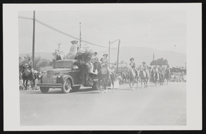
Postcard of Helldorado Parade, Boulder City (Nev.), 1950s
Date
1950 to 1959
Archival Collection
Description
Helldorado Parade in Boulder City, Nevada during the 1950s. Inscription with photo reads "D.D. entered while living in Pahrump. Won 2nd Prize. E(?) Bacus was one, beside D.D. on float. All were dressed in covered wagon style as #2.0" [identified by Dorothy Dorothy 11-1-84]
Image
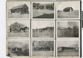

Photograph of a street in Goldfield (Nev.), September 1904
Date
1904-09
Archival Collection
Description
Caption: Goldfield Sept. 1904 No. 37
Image
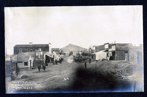
Photograph of buildings on Main Street, Goldfield (Nev.), early 1900s
Archival Collection
Description
Caption: Goldfield, Nev., Main St. looking north 4-9
Image
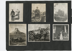
Photograph album 2, Ferron-Bracken Collection, circa 1905-1935, page 65
Date
1905 to 1935
Description
Photograph in upper left corner of this page is captioned "Hager's baby, Japan, 1906." Photograph in center of upper row is captioned "A.L. Hager, 1903." Photograph in upper right corner is captioned "Senator Tillman's castle, Yonkers, N.Y., 1906." Photograph in lower left corner is captioned "Black Hills, Dakota." Photograph in center of bottom row is captioned "Black Hills 1907." Photograph in lower right corner is captioned "Pasadena 1907-1908."
Image
Pagination
Refine my results
Content Type
Creator or Contributor
Subject
Archival Collection
Digital Project
Resource Type
Year
Material Type
Place
Language
Records Classification

