Search the Special Collections and Archives Portal
Search Results
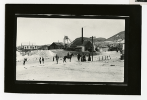
Photograph of the Tonopah Extension Mine Shaft No. 1, Tonopah (Nev.), 1908
Date
1908
Archival Collection
Description
Photograph of the Tonopah Extension Mine Shaft No. 1, Tonopah (Nev.), 1908
Image
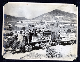
Photograph of advertisements on ore wagons at Tonopah Railroad Carnival, Tonopah (Nev.), early 1900s
Date
Unknown year in the decade of the 1900s
Archival Collection
Description
Photograph of advertisements on ore wagons at Tonopah Railroad Carnival, Tonopah (Nev.), early 1900s
Image
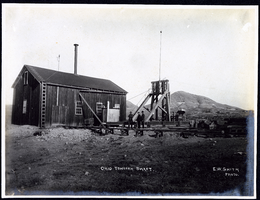
Photograph of Ohio Tonopah Shaft, Tonopah (Nev.), early 1900s
Archival Collection
Description
Caption: Ohio Tonopah Shaft
Image
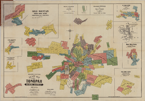
Map of the Tonopah Mining District, Tonopah (Nev.), 1903
Date
1903
Description
Rev. ed. ; Scale [ca. 1:10,800]. 1 inch to 900 feet ; 1 map : col. ; 76 x 102 cm., folded in cover to 21 x 11 cm ; Relief shown by hachures ; Cover title: Map of Tonopah, Gold Mountain and other adjacent mining districts, Nye and Esmeralda Counties ; Insets: Ray Mining District, vicinity map of Tonopah Mining District, Utopia Mining District, Tokop Mining District, Weepah Mining District, East Klondike Mining District, Gold Mountain, Tonopah Mining District and Red Mountain ; "Photo-lith. Britton & Rey, S.F." ; Includes advertisements
Image
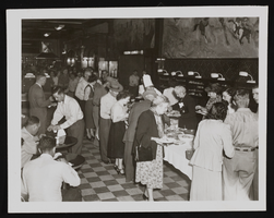
Photograph of the interior of the Tonopah Club, Tonopah (Nev.) 1900-1920
Date
1900 to 1920
Archival Collection
Description
Men and women gather to get some food, buffet style, inside the Tonopah Club. Site Name: Tonopah Club
Image
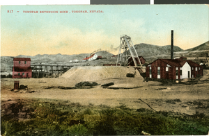
Postcard of Tonopah Extension Mine, Tonopah, Nevada, circa 1920s-1950s
Date
1920 to 1959
Archival Collection
Description
A colored view of the Tonopah Extension Mine in Tonopah, Nevada. Description provided on front of card: "Tonopah Extension Mine, Tonopah, Nevada."
Image

Photograph of Tonopah Midway Mine, Tonopah (Nev.), 1900-1920
Date
1900 to 1920
Archival Collection
Description
Midway Mine, an underground minerals site in Tonopah, Nevada, is the potential location for silver to be mined. Black smoke rises from the smokestack with the site sitting atop a dirt surface. Written lightly in the center of the photograph reads "Midway Mine, Tonopah Nev." Site Name: Tonopah Midway Mine
Image
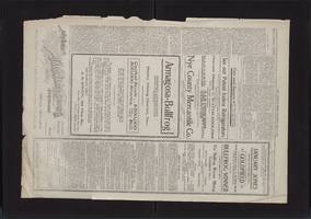
Newspaper, The Tonopah Miner, May 6, 1905
Date
1905-05-06
Description
Map from Tonopah to Bullfrog
Text
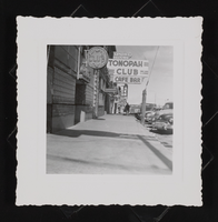
Photograph of entryway to the Tonopah Club, Tonopah (Nev.), 1900-1920
Date
1900 to 1920
Archival Collection
Description
Sidewalk view of a man leaving the "Tonopah Club, Cafe, Bar, & Kendall Rooms." In the distance you can see the "Ace Club" and "Nevada Cafe" on the same street. Site Name: Tonopah Club
Image
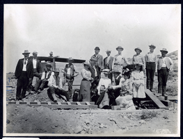
Photograph of people at Montana Tonopah Mine, Tonopah (Nev.), early 1900s
Date
Unknown year in the decade of the 1900s
Archival Collection
Description
Photograph of people at Montana Tonopah Mine, Tonopah (Nev.), early 1900s
Image
Pagination
Refine my results
Content Type
Creator or Contributor
Subject
Archival Collection
Digital Project
Resource Type
Year
Material Type
Place
Language
Records Classification
