Search Results
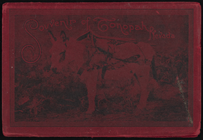
"Souvenir of Tonopah, Nevada" with photos from Goldfield, Tonopah, and Searchlight, Nevada: photograph album
Date
1900 to 1902
Archival Collection
Description
From the Nevada Mining Photograph Collection (PH-00361).
Image
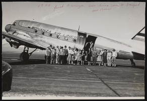
Photograph of an airplane at the Tonopah Air Base, 1944
Date
1944
Archival Collection
Description
A group of men and women gather around the first airplane to land to Tonopah Air Base from Bonanza Air Lines, Tonopah (Nev.), 1944
Image
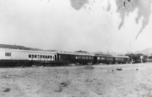
Tonopah and Tidewater Railroad cars: photographic print
Date
1937 to 1939
Archival Collection
Description
From the Nye County, Nevada Photograph Collection (PH-00221) -- Series III. Beatty, Nevada -- Subseries III.G. Reidhead Family.
Image
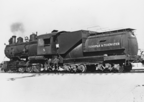
Negative: Tonopah and Tidewater Engine No. 8: photographic print
Date
1930 (year approximate)
Archival Collection
Description
From the Nye County, Nevada Photograph Collection (PH-00221) -- Series III. Beatty, Nevada -- Subseries III.G. Reidhead Family.
Image
Invitation to a graduation, Tonopah (Nev.), June 5, 1935
Date
1935-06-05
Description
The front of the invitation celebrating the 1935 graduating class of Tonopah High School.
Image
Invitation for a graduation, Tonopah (Nev.), June 3, 1936
Date
1936-06-03
Description
The front of the invitation to a Tonopah High School graduation. The letters THS are bolded on the front.
Image
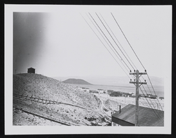
Tonopah's desert, image 001: photographic print
Date
1908
Archival Collection
Description
Photograph taken near Tonopah, Nevada in 1908.
Image

Lights of Tonopah during the nighttime: photographic print
Date
1906 (year approximate)
Archival Collection
Description
A photograph of Tonopah, Nevada at night circa 1906.
Image
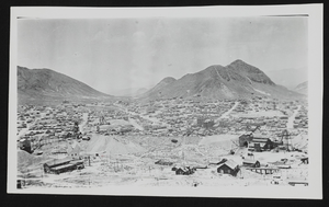
Town view of Tonopah (Nev.): photographic print
Date
1906 (year approximate)
Archival Collection
Description
A small panorama of Tonopah, Nevada in circa 1906.
Image
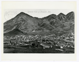
Postcard of a view of Tonopah (Nev.), October 7, 1912
Date
1912-10-07
Archival Collection
Description
Caption: General view of Tonopah, Nev.
Image