Search Results
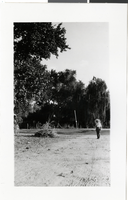
Photograph of Las Vegas Ranch, Las Vegas, circa 1930s
Date
1930 to 1939
Archival Collection
Description
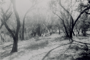
Black and white image of a man with a pipe and umbrella walking down a road at the "Old Las Vegas Ranch." This picture was identified by Shirley Ferron Swanson on October 25, 1983. Site Name: Las Vegas Ranch (Las Vegas, Nev.)
Image
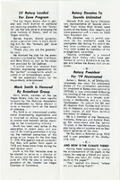
The Wheel Las Vegas Rotary Club newsletter, late 1970s
Date
1975 to 1978
Archival Collection
Description
Newsletter issued by the Las Vegas Rotary Club
Text
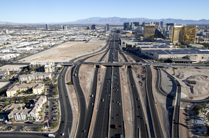
Las Vegas resort corridor, Las Vegas, Nevada: digital photograph
Date
2016-03-23
Archival Collection
Description
Photograph of the Interstate 15 corridor and the Las Vegas Strip, looking north, Las Vegas, Nevada. March 23, 2016.
Image
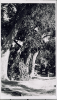
Transparency of Las Vegas Ranch, Las Vegas, circa early 1900s
Date
1900 to 1939
Archival Collection
Description
A view of the Las Vegas Ranch in Las Vegas, Nevada. Site Name: Las Vegas Ranch (Las Vegas, Nev.)
Image
Transparency of Las Vegas Ranch, Las Vegas, circa early 1900s
Date
1900 to 1939
Archival Collection
Description
A view of the Las Vegas Ranch in Las Vegas, Nevada. Site Name: Las Vegas Ranch (Las Vegas, Nev.)
Image
Film transparency of Las Vegas High School, Las Vegas, February 22, 1930
Date
1930-02-22
Archival Collection
Description
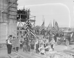
Unidentified children carrying flags and signs at the cornerstone-laying ceremony for the new Las Vegas High School in Las Vegas, Nevada.
Image
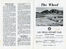
The Wheel Las Vegas Rotary Club newsletter, December 9, 1976
Date
1976-12-09
Archival Collection
Description
Newsletter issued by the Las Vegas Rotary Club
Text

The Wheel Las Vegas Rotary Club newsletter, August 4, 1977
Date
1977-08-04
Archival Collection
Description
Newsletter issued by the Las Vegas Rotary Club
Text
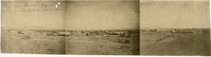
Panoramic view of Clark's Las Vegas Townsite, Las Vegas (Nev.), 1905
Date
1905
Archival Collection
Description
Three photographs placed together to create a panoramic view of Clark's Las Vegas Townsite.
Caption: Los [sic] Vegas Nevada, Aug 1905 from Salt Lake Depot then under construction
Caption: Los [sic] Vegas Nevada, Aug 1905 from Salt Lake Depot then under construction
Image
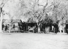
Photograph of Las Vegas Ranch, Las Vegas, circa 1900-1926
Date
1900 to 1926
Archival Collection
Description
The view of homes at the Las Vegas Ranch in Las Vegas, Nevada. Site Name: Las Vegas Ranch (Las Vegas, Nev.)
Image