Search Results
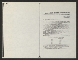
Law School Study for the University of Nevada, Las Vegas from Southwestern-Nevada Law Review
Date
Archival Collection
Description
A loose paper version of "Law School Study for the University of Nevada, Las Vegas" by Willard H. Pedrick and Lorne Seidman, photocopied from the Southwestern-Nevada Law Review, Volume 10, 1978. From the University of Nevada, Las Vegas William S. Boyd School of Law Records (UA-00048).
Text
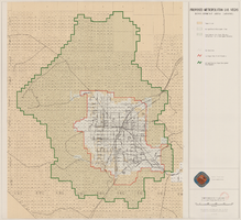
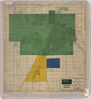
Map showing proposed metropolitan Las Vegas development area, June 24, 1997
Date
Description
Image
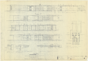
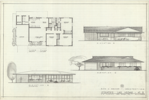
Architectural drawings of a residential home in Las Vegas, Nevada, November 2, 1962
Date
Description
Exterior elevations and details for a residential home on Fifth Place in Las Vegas, Nevada. Sheet no. 4. "Drw. D.H."
Architecture Period: Mid-Century ModernistImage
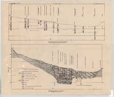
Cross-sections of wells and aquifers in the Las Vegas Valley, circa 1946
Date
Description
Text
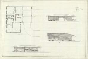
Architectural drawings of residential home in Las Vegas, Nevada, floor plan and three elevations, 1955
Date
Archival Collection
Description
Floor plan with three different front exterior elevations for a ranch-style residential home in the Greater Las Vegas development in Las Vegas, Nevada. Floor plan is labeled "Plan 10," and elevations are labeled A, B and C.
Site Name: Greater Las Vegas
Image
Architectural drawings of residential home in Las Vegas, Nevada, floor plan and three elevations, 1955
Date
Archival Collection
Description
Floor plan with three different front exterior elevations for a ranch-style residential home in the Greater Las Vegas development in Las Vegas, Nevada. Floor plan is labeled "Plan 11," and elevations are labeled A,B and C.
Site Name: Greater Las Vegas
Image
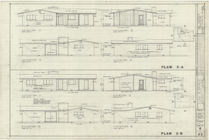
Architectural drawings of residential home in Las Vegas, Nevada, exterior elevations, May 23, 1958
Date
Archival Collection
Description
Two different sets of drawings of front, rear, left and right exterior elevations and roof plans for a ranch-style residential home in the Las Verdes Heights development in Las Vegas, Nevada. Drawing sets labeled Plan 5-A and Plan 5-B. "Drawn by J.C.M. Checked by E.C.B." "Sheet no. 6 of 25."
Site Name: Las Verdes Heights
Image
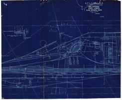
Map showing water pipelines, Las Vegas, Nevada, January 15, 1914
Date
Archival Collection
Description
Image
Map of Las Vegas and vicinity, Clark County, Nevada, April 15, 1951
Date
Description
Image
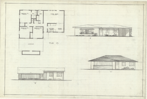
Architectural drawings of residential home in Las Vegas, Nevada, floor plan and three exterior elevations, 1955
Date
Archival Collection
Description
Floor plan and three different front exterior elevation drawings for a ranch-style residential home in the Greater Las Vegas development in Las Vegas, Nevada. Elevations are labeled A, B and C. "10" appears in a circle above the architect's name.
Site Name: Greater Las Vegas
Image