Search the Special Collections and Archives Portal
Search Results
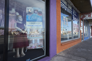
A street scene is reflected in the front window of the Miss 15 dress shop on Charleston Boulevard near Eastern Avenue, looking southwest in Las Vegas, Nevada: digital photograph
Date
Archival Collection
Description
From the UNLV University Libraries Photographs of the Development of the Las Vegas Valley, Nevada (PH-00394). Part of the collection documents the entire 19 mile length of the north/south Eastern Avenue / Civic Center Drive alignment. This photograph was captured in the section of Eastern Avenue between Stewart Avenue and Charleston Boulevard.
Image
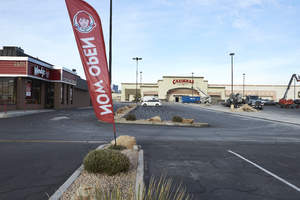
A Wendy's fast food store and a Cardenas grocery store along Eastern Avenue near Sahara Avenue, looking west-southwest in Las Vegas, Nevada: digital photograph
Date
Archival Collection
Description
From the UNLV University Libraries Photographs of the Development of the Las Vegas Valley, Nevada (PH-00394). Part of the collection documents the entire 19 mile length of the north/south Eastern Avenue / Civic Center Drive alignment. This photograph was captured in the section of Eastern Avenue between Sahara Avenue and Desert Inn Road.
Image
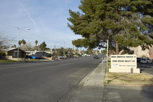
A single family home neighborhood lines the south side of Vegas Valley Drive near Eastern Avenue, looking west-southwest in Las Vegas, Nevada: digital photograph
Date
Archival Collection
Description
From the UNLV University Libraries Photographs of the Development of the Las Vegas Valley, Nevada (PH-00394). Part of the collection documents the entire 19 mile length of the north/south Eastern Avenue / Civic Center Drive alignment. This photograph was captured in the section of Eastern Avenue between Sahara Avenue and Desert Inn Road.
Image
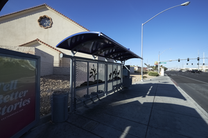
A bus shelter sits our front of St. Viator Catholic Church on Flamingo Road near Eastern Avenue, looking southwest in Las Vegas, Nevada: digital photograph
Date
Archival Collection
Description
From the UNLV University Libraries Photographs of the Development of the Las Vegas Valley, Nevada (PH-00394). Part of the collection documents the entire 19 mile length of the north/south Eastern Avenue / Civic Center Drive alignment. This photograph was captured in the section of Eastern Avenue between Flamingo Road and Tropicana Avenue.
Image
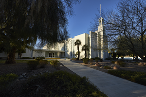
Exterior view of a Church of Jesus Christ of Latter Day Saints on Tropicana Avenue near Eastern Avenue, looking south-southwest in Las Vegas, Nevada: digital photograph
Date
Archival Collection
Description
From the UNLV University Libraries Photographs of the Development of the Las Vegas Valley, Nevada (PH-00394). Part of the collection documents the entire 19 mile length of the north/south Eastern Avenue / Civic Center Drive alignment. This photograph was captured in the section of Eastern Avenue between Tropicana Avenue and Russell Road.
Image
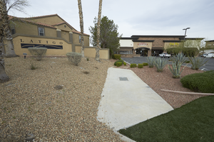
Multi-family housing and commercial development mix off Eastern Avenue north of Silverado Ranch Boulevard, looking west-southwest in Las Vegas, Nevada: digital photograph
Date
Archival Collection
Description
From the UNLV University Libraries Photographs of the Development of the Las Vegas Valley, Nevada (PH-00394). Part of the collection documents the entire 19 mile length of the north/south Eastern Avenue / Civic Center Drive alignment. This photograph was captured in the section of Eastern Avenue between Pebble Road and Silverado Ranch Boulevard.
Image
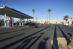
An Albertson's Mobil gas station in the Warm Springs Marketplace on Eastern Avenue north of Warm Springs Road, looking west-southwest in Las Vegas, Nevada: digital photograph
Date
Archival Collection
Description
From the UNLV University Libraries Photographs of the Development of the Las Vegas Valley, Nevada (PH-00394). Part of the collection documents the entire 19 mile length of the north/south Eastern Avenue / Civic Center Drive alignment. This photograph was captured in the section of Eastern Avenue between Sunset and Warm Springs Roads.
Image
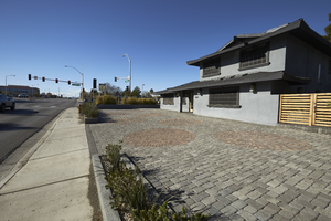
A single family home converted for business use the northwest corner of Sahara Avenue and East Viking Road, looking south-southwest in Las Vegas, Nevada: digital photograph
Date
Archival Collection
Description
From the UNLV University Libraries Photographs of the Development of the Las Vegas Valley, Nevada (PH-00394). Part of the collection documents the entire 19 mile length of the north/south Eastern Avenue / Civic Center Drive alignment. This photograph was captured in the section of Eastern Avenue between Desert Inn and Flamingo Roads.
Image
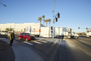
A FedEx truck exits the air cargo section of McCarran International Airport at Russell Road and Surrey Street, looking west-southwest in Las Vegas, Nevada: digital photograph
Date
Archival Collection
Description
From the UNLV University Libraries Photographs of the Development of the Las Vegas Valley, Nevada (PH-00394). Part of the collection documents the entire 19 mile length of the north/south Eastern Avenue / Civic Center Drive alignment. This photograph was captured in the section of Eastern Avenue between Russell and Sunset Roads.
Image
People view and work on the crosses at the 1 October memorial located at the Welcome to Las Vegas sign, looking south-southwest in Las Vegas, Nevada: digital photograph, 2017 October 06
Level of Description
Archival Collection
Collection Name: UNLV University Libraries Photographs of the Response to the 1 October Shooting in Las Vegas, Nevada
Box/Folder: Digital File 00
Archival Component
