Search Results
Desert and mountainous landscapes in the southwest United States, returned by "Shinner": photographic prints, 1941
Level of Description
Archival Collection
Collection Name: Howard Hughes Film Production Records
Box/Folder: Box 150 (Restrictions apply)
Archival Component
Southwest Gas Corporation, Victorville, California: exterior building rendering, approximately 1980 to 2000
Level of Description
Archival Collection
Collection Name: Domingo Cambeiro Corporation Architectural Records
Box/Folder: Flat File 17
Archival Component
Hentz, Joseph George, "Determinants of the structural niches of columnar cacti in the Southwest", 1991 Summer
Level of Description
Archival Collection
Collection Name: University of Nevada, Las Vegas Theses, Dissertations, and Honors Papers
Box/Folder: Box 068
Archival Component
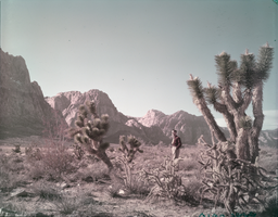
Film transparency showing Joshua trees in the Southwest desert, circa late 1930s-1950s
Date
Archival Collection
Description
Image
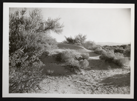
Photograph of desert sand dunes and brush in the Southwest United States, circa 1930s-1950s
Date
Archival Collection
Description
Image
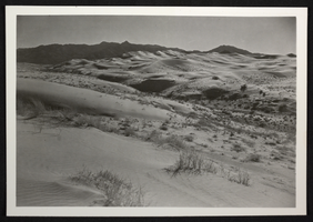
Photograph of desert sand dunes and brush in the Southwest United States, circa 1930s-1950s
Date
Archival Collection
Description
Image
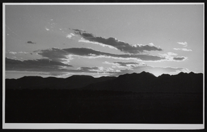
Photograph of sunset against the mountains in the desert, Southwest United States, circa 1930s-1950s
Date
Archival Collection
Description
Image
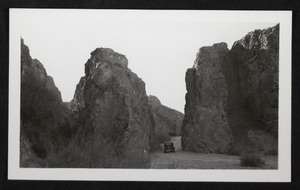
Photograph of road through desert mountains, Southwest United States, circa 1930s-1950s
Date
Archival Collection
Description
Image
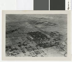
Aerial photograph of Las Vegas, full view of high school, southwest direction, 1930
Date
Archival Collection
Description
Aerial view of Las Vegas in 1930
Transcribed Notes: Notes on back of duplicate photo: Aerial view of Las Vegas w/ new high school on bottom left, c. 1933; Notes on photo sleeve: Aerial view of Las Vegas taken in the winter of 1930 (same day as #0123 002) in clip wing Jenny. Shows railroad and main street - essentially shows the whole city. (Credit: W.A. Davis)
Image
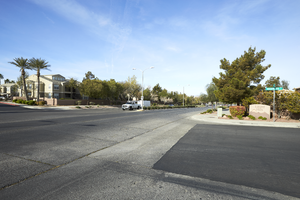
Sunridge Heights Parkway at Dashwood Street, looking southwest in Henderson, Nevada: digital photograph
Date
Archival Collection
Description
From the UNLV University Libraries Photographs of the Development of the Las Vegas Valley, Nevada (PH-00394). Part of the collection documents the entire 19 mile length of the north/south Eastern Avenue / Civic Center Drive alignment. This photograph was captured in the section of Eastern Avenue between Coronado Center Drive and Sunridge Heights Parkway.
Image