Search the Special Collections and Archives Portal
Search Results
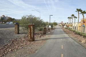
St. Rose Parkway Trail cuts along a commercial development on the north side of St. Rose Parkway near Eastern Avenue, looking southwest in Las Vegas, Nevada: digital photograph
Date
Archival Collection
Description
From the UNLV University Libraries Photographs of the Development of the Las Vegas Valley, Nevada (PH-00394). Part of the collection documents the entire 19 mile length of the north/south Eastern Avenue / Civic Center Drive alignment. This photograph was captured in the section of Eastern Avenue between Silverado Ranch Boulevard and Coronado Center Drive.
Image
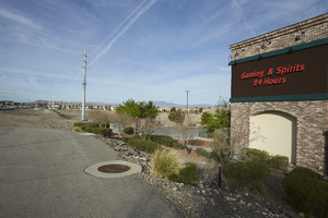
St. Rose Parkway Trail ends in an undeveloped lot on the north side of St. Rose Parkway west of Eastern Avenue, looking west-southwest in Las Vegas, Nevada: digital photograph
Date
Archival Collection
Description
From the UNLV University Libraries Photographs of the Development of the Las Vegas Valley, Nevada (PH-00394). Part of the collection documents the entire 19 mile length of the north/south Eastern Avenue / Civic Center Drive alignment. This photograph was captured in the section of Eastern Avenue between Silverado Ranch Boulevard and Coronado Center Drive.
Image
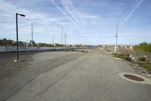
St. Rose Parkway Trail ends in an undeveloped lot on the north side of St. Rose Parkway west of Eastern Avenue, looking south-southwest in Las Vegas, Nevada: digital photograph
Date
Archival Collection
Description
From the UNLV University Libraries Photographs of the Development of the Las Vegas Valley, Nevada (PH-00394). Part of the collection documents the entire 19 mile length of the north/south Eastern Avenue / Civic Center Drive alignment. This photograph was captured in the section of Eastern Avenue between Silverado Ranch Boulevard and Coronado Center Drive.
Image
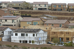
Lennar Development's Aventine neighborhood under construction as seen from Pecos Ridge Parkway west of Eastern Avenue with custom homes above, looking southwest in Henderson, Nevada: digital photograph
Date
Archival Collection
Description
From the UNLV University Libraries Photographs of the Development of the Las Vegas Valley, Nevada (PH-00394). Part of the collection documents the entire 19 mile length of the north/south Eastern Avenue / Civic Center Drive alignment. This photograph was captured in the section of Eastern Avenue between Sunridge Heights Parkway and Grand Hills Drive.
Image

Mid-century modern inspired block wall design in disrepair off Desert Inn Road near Eastern Avenue, looking west-southwest in Las Vegas, Nevada: digital photograph
Date
Archival Collection
Description
From the UNLV University Libraries Photographs of the Development of the Las Vegas Valley, Nevada (PH-00394). Part of the collection documents the entire 19 mile length of the north/south Eastern Avenue / Civic Center Drive alignment. This photograph was captured in the section of Eastern Avenue between Desert Inn and Flamingo Roads.
Image
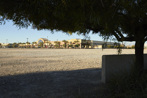
Undeveloped land inside the McCarran Marketplace as seen from Russell Road near Eastern Avenue with a Lowes Home Improvement store, looking southwest in Las Vegas, Nevada: digital photograph
Date
Archival Collection
Description
From the UNLV University Libraries Photographs of the Development of the Las Vegas Valley, Nevada (PH-00394). Part of the collection documents the entire 19 mile length of the north/south Eastern Avenue / Civic Center Drive alignment. This photograph was captured in the section of Eastern Avenue between Russell and Sunset Roads.
Image
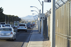
Traffic flows on Eastern Avenue next to the McCarran International Airport fence as seen from Eastern Avenue and Patrick Lane, looking south-southwest in Las Vegas, Nevada: digital photograph
Date
Archival Collection
Description
From the UNLV University Libraries Photographs of the Development of the Las Vegas Valley, Nevada (PH-00394). Part of the collection documents the entire 19 mile length of the north/south Eastern Avenue / Civic Center Drive alignment. This photograph was captured in the section of Eastern Avenue between Russell and Sunset Roads.
Image
Messages, left as part of the 1 October memorial, cover a utility box near the Welcome to Las Vegas sign, looking west-southwest in Las Vegas, Nevada: digital photograph, 2017 October 18
Level of Description
Archival Collection
Collection Name: UNLV University Libraries Photographs of the Response to the 1 October Shooting in Las Vegas, Nevada
Box/Folder: Digital File 00
Archival Component
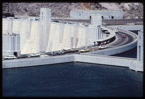
Water reaches the high point as automobiles and pedestrians cross the top of the dam as seen from above the Arizona spillway, looking southwest towards the Nevada side at Hoover Dam, Arizona: photographic slide
Date
Archival Collection
Description
Image
A Southwest Airline plane lands at McCarran International Airport as traffic navigates the intersection of Sunset Road and Eastern Avenue, looking west-northwest in Las Vegas, Nevada: digital photograph, 2019 March 18
Level of Description
Archival Collection
Collection Name: UNLV University Libraries Photographs of the Development of the Las Vegas Valley, Nevada
Box/Folder: N/A
Archival Component
