Search the Special Collections and Archives Portal
Search Results
Aerial view, southwest, of chlorine area, showing cell buildings No. 1 and No. 2, liquefaction, cell renewal, and caustic buildings, boiler house, and brine system: photographic print, 1942 July 15
Level of Description
Archival Collection
Collection Name: Basic Magnesium, Inc. (BMI) Records and Photographs
Box/Folder: Box 05
Archival Component
Aerial image of four Southwest Airlines airplanes on taxiway lining up before runway at McCarran International Airport in Las Vegas, Nevada: photographic print, approximately 1997 to 2002
Level of Description
Archival Collection
Collection Name: Brian Jones Collection of Henderson, Nevada Aerial Photographs
Box/Folder: Box SH-049
Archival Component
Aerial image of two Southwest Airlines airplanes on taxiway lining up before runway at McCarran International Airport in Las Vegas, Nevada: photographic print, approximately 1997 to 2002
Level of Description
Archival Collection
Collection Name: Brian Jones Collection of Henderson, Nevada Aerial Photographs
Box/Folder: Box SH-049
Archival Component
Lavern Cummings private recording of "Speak Low;" produced by the Southwest Recording Service in Dallas, Texas during his time as a Jewel Box Revue cast member, 1951 June
Level of Description
Archival Collection
Collection Name: Paul Lavern Cummings Papers
Box/Folder: Digital File 00
Archival Component
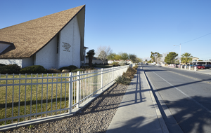
The Church of Jesus Christ of Latter-day Saints on East Tonopah Avenue and Civic Center Drive, looking west-southwest in North Las Vegas, Nevada: digital photograph
Date
Archival Collection
Description
From the UNLV University Libraries Photographs of the Development of the Las Vegas Valley, Nevada (PH-00394). Part of the collection documents the entire 19 mile length of the north/south Eastern Avenue / Civic Center Drive alignment. This photograph was captured in the section of Civic Center Drive and Eastern Avenue between Lake Mead Boulevard and Washington Avenue.
Image
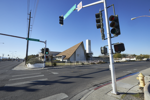
The Church of Jesus Christ of Latter-day Saints on East Tonopah Avenue and Civic Center Drive, looking south-southwest in North Las Vegas, Nevada: digital photograph
Date
Archival Collection
Description
From the UNLV University Libraries Photographs of the Development of the Las Vegas Valley, Nevada (PH-00394). Part of the collection documents the entire 19 mile length of the north/south Eastern Avenue / Civic Center Drive alignment. This photograph was captured in the section of Civic Center Drive and Eastern Avenue between Lake Mead Boulevard and Washington Avenue.
Image
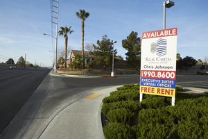
Landscaping and signs for a commercial development next to single family homes on Eastern Avenue south of Windmill Parkway, looking south-southwest in Las Vegas, Nevada: digital photograph
Date
Archival Collection
Description
From the UNLV University Libraries Photographs of the Development of the Las Vegas Valley, Nevada (PH-00394). Part of the collection documents the entire 19 mile length of the north/south Eastern Avenue / Civic Center Drive alignment. This photograph was captured in the section of Eastern Avenue between Windmill Parkway and Pebble Road.
Image
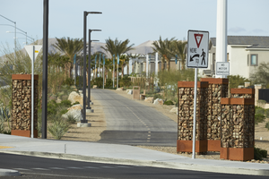
The St. Rose Parkway Trail at Jeffreys Street on the north side of St. Rose Parkway west of Eastern Avenue, looking southwest in Las Vegas, Nevada: digital photograph
Date
Archival Collection
Description
From the UNLV University Libraries Photographs of the Development of the Las Vegas Valley, Nevada (PH-00394). Part of the collection documents the entire 19 mile length of the north/south Eastern Avenue / Civic Center Drive alignment. This photograph was captured in the section of Eastern Avenue between Silverado Ranch Boulevard and Coronado Center Drive.
Image
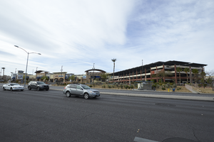
The Dignity Health St. Rose Dominican's parking garage off Eastern Avenue near St. Rose Parkway, looking south-southwest in Henderson, Nevada: digital photograph
Date
Archival Collection
Description
From the UNLV University Libraries Photographs of the Development of the Las Vegas Valley, Nevada (PH-00394). Part of the collection documents the entire 19 mile length of the north/south Eastern Avenue / Civic Center Drive alignment. This photograph was captured in the section of Eastern Avenue between Silverado Ranch Boulevard and Coronado Center Drive.
Image
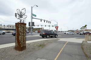
The St. Rose Parkway Trial on the north side meets up with the intersection of Eastern Avenue and St. Rose Parkway, looking south-southwest in Henderson, Nevada: digital photograph
Date
Archival Collection
Description
From the UNLV University Libraries Photographs of the Development of the Las Vegas Valley, Nevada (PH-00394). Part of the collection documents the entire 19 mile length of the north/south Eastern Avenue / Civic Center Drive alignment. This photograph was captured in the section of Eastern Avenue between Silverado Ranch Boulevard and Coronado Center Drive.
Image
