Search Results
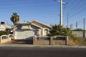
Single family homes and power lines off Sloan Lane south of East Sahara Avenue, looking northeast, Las Vegas, Nevada: digital photograph
Date
2017-09-28
Archival Collection
Description
Power lines dominate the single family neighborhood along Ruby Creek Drive off Sloan Lane, south of East Sahara Avenue.
Image

The Source Dispensary medical marijuana buiness on West Sahara Avenue and South Rainbow Boulevard looking west, Las Vegas, Nevada: digital photograph
Date
2017-08-30
Archival Collection
Description
Traffic flows along West Sahara Avenue at the South Rainbow Boulevard interchange. With the recent passing of both medical and recreational marijuana sales initiatives, businesses like The Source Dispensary have popped up along the major thoroughfare.
Image
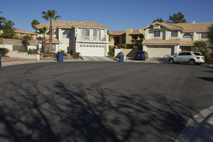
Single family housing next to multi-family housing off Fort Apache Road and West Sahara Avenue, Las Vegas, Nevada: digital photograph
Date
2017-10-10
Archival Collection
Description
Single family homes on Cloudsdale Circle share a boundary with the Summerhill Pointe Apartments west of Fort Apache Road and south of West Sahara Avenue.
Image
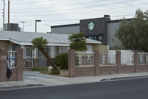
Single family house next to Starbucks Coffee on West Sahara Avenue at Rye Street, looking northwest, Las Vegas, Nevada: digital photograph
Date
2017-09-06
Archival Collection
Description
The recently built Starbuck Coffee on West Sahara Avenue at Rye Street. The new addition to the neighborhood brings a more modern look to the late 20th century neighborhood and illustrates the contrast and difficulty in single family home to commercial zoning.
Image
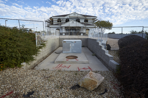
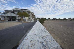
Future home of the Smith Plastic Surgery Institute on West Sahara Avenue east of Buffalo Drive, looking north, Las Vegas, Nevada: digital photograph
Date
2017-10-11
Archival Collection
Description
A utility box sits directly in front of the future home of the Smith Plastic Surgery Institute on West Sahara Avenue east of Buffalo Drive.
Image
Future home of the Smith Plastic Surgery Institute on West Sahara Avenue east of Buffalo Drive, looking north, Las Vegas, Nevada: digital photograph
Date
2017-10-11
Archival Collection
Description
A wall divides the future home of the Smith Plastic Surgery Institute and undeveloped land along West Sahara Avenue east of Buffalo Drive.
Image
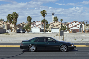
Homes on Stockton Avenue and vacant land on South Eastern Avenue north of East Sahara Avenue looking west, Las Vegas, Nevada: digital photograph
Date
2017-09-13
Archival Collection
Description
Single family homes on Stockton Avenue are seen behind an undeveloped parcel of land on South Eastern Avenue north of East Sahara Avenue as traffic flows by.
Image
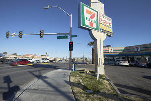
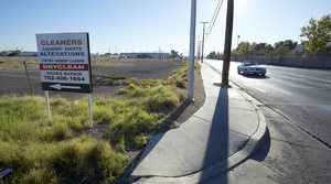
Commercial signage on the northeast corner of Eastern Avenue near Sahara Avenue, looking north-west in Las Vegas, Nevada: digital photograph
Date
2019-02-28
Archival Collection
Description
From the UNLV University Libraries Photographs of the Development of the Las Vegas Valley, Nevada (PH-00394). Part of the collection documents the entire 19 mile length of the north/south Eastern Avenue / Civic Center Drive alignment. This photograph was captured in the section of Eastern Avenue between Charleston Boulevard and Sahara Avenue.
Image
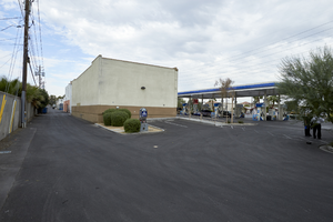
Alley behind businesses along West Sahara Avenue at South Valley View Boulevard looking west, Las Vegas, Nevada: digital photograph
Date
2017-09-06
Archival Collection
Description
An alley divides commercial and single family housing zones the entire section along the south side of West Sahara Avenue from South Arville Street to South Valley View Boulevard. This section is looking west from South Valley View Boulevard.
Image
East Karen Avenue near East Sahara Avenue west of Maryland Parkway, Las Vegas, Nevada: digital photograph
Date
2017-09-12
Archival Collection
Description
Looking east down East Karen Avenue near the Commercial Center. To the south of Karen Avenue is the Las Vegas Country Club Estates.
Image