Search Results

Architectural drawing of Sahara Hotel 400 hi-rise addition (Las Vegas), typical floor and dignitary suite plan, December 29, 1961
Date
1961-12-29
Archival Collection
Description
Architectural plans for the addition of a hotel tower for the Sahara from 1961. Includes revisions and floor plan notes. Printed on onion skin. Leon Gluckson, architect; Berton Charles Severson, architect.
Site Name: Sahara Hotel and Casino
Address: 2535 Las Vegas Boulevard South
Image
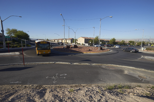
School bus using the roundabout that makes up the intersection of East Sahara Avenue and Hollywood Boulevard, looking south, Las Vegas, Nevada: digital photograph
Date
2017-09-29
Archival Collection
Description
A school bus uses the intersection of East Sahara Avenue and Hollywood Boulevard.
Image
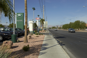
Land Rover of Las Vegas and auto dealerships on West Sahara Avenue west of Decatur Boulevard, looking west, Las Vegas, Nevada: digital photograph
Date
2017-09-19
Archival Collection
Description
Auto dealerships line West Sahara Avenue west of Decatur Boulevard.
Image
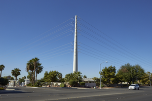
Power pole turns away from East Sahara Avenue west of Tree Line Drive, looking southwest, Las Vegas, Nevada: digital photograph
Date
2017-09-28
Archival Collection
Description
A major power line makes a ninety-degree turn away from East Sahara Avenue west of Tree Line Drive. Sahara Avenue is a major power transmission line route for most of its 18 mile stretch.
Image
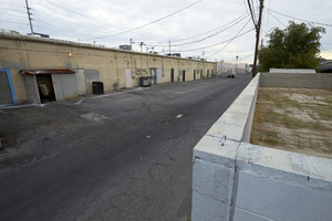
Alley behind businesses along West Sahara Avenue at Las Verdes Street looking east, Las Vegas, Nevada: digital photograph
Date
2017-09-06
Archival Collection
Description
An alley divides commercial and single family housing zones the entire section along the south side of West Sahara Avenue from South Arville Street to South Valley View Boulevard. This section is looking east from Las Verdes Street.
Image
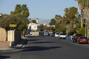
Slice Drive off Sloan Lane north of East Sahara Avenue with Stratosphere Tower, looking west, Las Vegas, Nevada: digital photograph
Date
2017-09-28
Archival Collection
Description
A single family neighborhood along Slice Drive off Sloan Lane north of East Sahara Avenue. The Stratosphere Tower can be seen in the distance.
Image
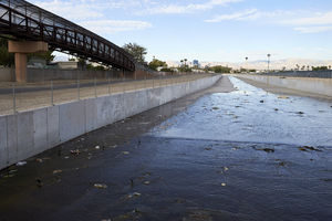
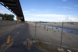
Bridge and Flamingo Wash as seen from Lamb Boulevard south of East Sahara Avenue, looking west, Las Vegas, Nevada: digital photograph
Date
2017-09-26
Archival Collection
Description
A bridge that is part of the Flamingo Arroyo Trail system parallels the Flamingo Wash as it makes its way to Lamb Boulevard south of East Sahara Avenue.
Image
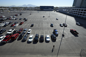
SLS employee parking lot south of East Sahara Avenue and east of Paradise Road Looking northeast, Las Vegas, Nevada: digital photograph
Date
2017-09-12
Archival Collection
Description
The employee parking lot of the SLS Hotel and Casino as seen from the Las Vegas Monorail station on Paradis Road south of East Sahara Avenue.
Image