Search Results
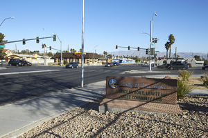
Signage for the city park on Eastern Avenue near Sahara Avenue, looking north-west in Las Vegas, Nevada: digital photograph
Date
Archival Collection
Description
From the UNLV University Libraries Photographs of the Development of the Las Vegas Valley, Nevada (PH-00394). Part of the collection documents the entire 19 mile length of the north/south Eastern Avenue / Civic Center Drive alignment. This photograph was captured in the section of Eastern Avenue between Charleston Boulevard and Sahara Avenue.
Image

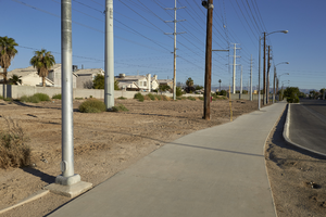
A block wall and sidewalk along Tree Line Drive north of East Sahara Avenue, looking north, Las Vegas, Nevada: digital photograph
Date
Archival Collection
Description
Image

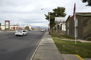
Bus stop near apartments on East Sahara Avenue west of Tree Line Drive, looking north, Las Vegas, Nevada: digital photograph
Date
Archival Collection
Description
Image

Stairs at Summerhill Pointe Apartments on West Sahara Avenue west of Fort Apache Road, looking west, Las Vegas, Nevada: digital photograph
Date
Archival Collection
Description
Image
Power line easment with sidewalk along Sloan Lane south of East Sahara Avenue, looking north, Las Vegas, Nevada: digital photograph
Date
Archival Collection
Description
Image
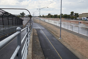
Flamingo Arroyo Trail and Flamingo Wash at Nellis Bouleavard south of East Sahara Avenue looking west, Clark County, Nevada: digital photograph
Date
Archival Collection
Description
Image
Flamingo Arroyo Trail and Flamingo Wash at Nellis Bouleavard south of East Sahara Avenue looking west, Clark County, Nevada: digital photograph
Date
Archival Collection
Description
Image
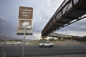
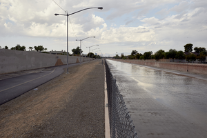
Flamingo Arroyo Trail and elevated crosswalk at Nellis Bouleavard south of East Sahara Avenue looking east, Clark County, Nevada: digital photograph
Date
Archival Collection
Description
Image
The Lake Sahara Apartments on Eastern Avenue at East Karen Avenue, looking north-northwest in Las Vegas, Nevada: digital photograph
Date
Archival Collection
Description
From the UNLV University Libraries Photographs of the Development of the Las Vegas Valley, Nevada (PH-00394). Part of the collection documents the entire 19 mile length of the north/south Eastern Avenue / Civic Center Drive alignment. This photograph was captured in the section of Eastern Avenue between Sahara Avenue and Desert Inn Road.
Image
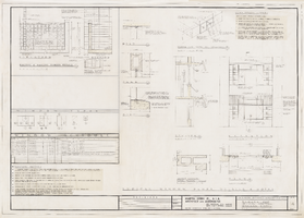
Architectural drawing of Sahara Hotel 400 hi-rise addition (Las Vegas), typical window openings, schedule, and details, December 29, 1961
Date
Archival Collection
Description
Architectural plans for the addition of a hotel tower for the Sahara from 1961. Includes revisions, sun shade notes, window schedule and window notes. Printed on onion skin. Leon Gluckson, architect; Berton Charles Severson, architect.
Site Name: Sahara Hotel and Casino
Address: 2535 Las Vegas Boulevard South
Image