Search the Special Collections and Archives Portal
Search Results
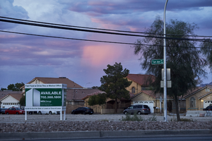
Vacant land off East Sahara Avenue looking northeast at dusk, Las Vegas, Nevada: digital photograph
Date
2017-09-13
Archival Collection
Description
An billboard advertises vacant land between Burnham and Eastern Avenues along East Sahara Avenue at dusk.
Image
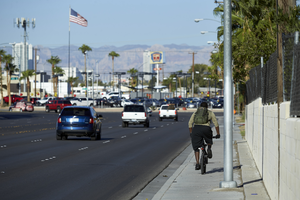
Traffic on East Sahara Avenue near Boulder Highway looking west, Las Vegas, Nevada: digital photograph
Date
2017-09-14
Archival Collection
Description
A bicyclist uses the sidewalk as traffic flows along East Sahara Avenue as it curves towards Boulder Highway.
Image
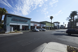
Businesses in strip mall north of West Sahara Avenue looking northeast, Las Vegas, Nevada: digital photograph
Date
2017-08-31
Archival Collection
Description
Businesses occupy a strip mall developed off Paseo Del Prado near West Sahara Avenue.
Image
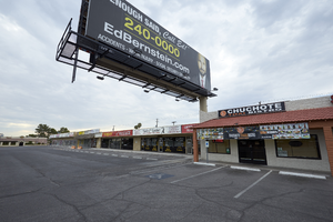
Billboard overshadows a strip mall on West Sahara Avenue looking southeast, Las Vegas, Nevada: digital photograph
Date
2017-09-06
Archival Collection
Description
A billboard looms over a strip mall on West Sahara Avenue west of South Valley View Boulevard.
Image
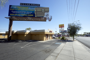
Billboards on east Sahara Avenue near Paradise Road looking east, Las Vegas, Nevada: digital photograph
Date
2017-09-12
Archival Collection
Description
Billboards in the area of Paradise Road and East Sahara Avenue are allowed and often overshadow the buildings they share land with.
Image
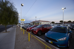
Used car lot on East Sahara Avenue looking east at dusk, Las Vegas, Nevada: digital photograph
Date
2017-09-12
Archival Collection
Description
Used cars sit in the Hertz sales lot on East Sahara Avenue near South Bruce Street.
Image
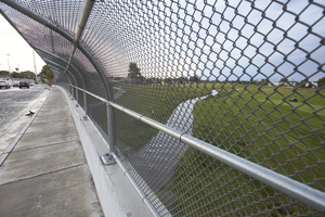
Cars on East Sahara Avenue at the Club at Sunrise Golf Course, Clark County, Nevada: digital photograph
Date
2017-09-08
Archival Collection
Description
Cars travel on East Sahara Avenue over the Las Vegas Wash at the Club at Sunrise Golf Course. Originally opened as The Winterwood Golf Club in 1964, the Club at Sunrise Golf Course was redesigned as part of the Las Vegas Wash Project in 2016.
Image
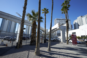
Monorail at East Sahara Avenue and Paradise Road looking south, Las Vegas, Nevada: digital photograph
Date
2017-09-12
Archival Collection
Description
A section of the Las Vegas Monorail curves towards its northernmost station at the SLS hotel and casino near the intersection of East Sahara Avenue and Paradise Road. The terminated track to the right was installed in anticipation of the line being extended to Downtown Las Vegas.
Image
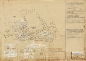
Architectural drawing of addition, Sahara Hotel and Casino (Las Vegas), plot plan and notes, March 18, 1960
Date
1960-03-18
Archival Collection
Description
Partial plot plan and parking plan for the renovation of the Sahara. Includes bumper and concrete curb details, and notes on the plot and parking plans, roofing, and on building waste drains and sewer. Printed on onion skin.
Site Name: Sahara Hotel and Casino
Address: 2535 Las Vegas Boulevard South
Image
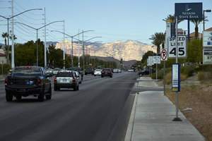
Red Rock Canyon behind West Sahara Avenue looking west, Las Vegas, Nevada: digital photograph
Date
2017-08-29
Archival Collection
Description
The sun lights up Red Rock Canyon as traffic flows along West Sahara Avenue as seen from the the corner of South Cimarron Road and West Sahara Avenue. August 29, 2017 UNLV Libraries Special Collections / Aaron Mayes N36 °08.644' x W115 °16.213')
Image
Pagination
Refine my results
Content Type
Creator or Contributor
Subject
Archival Collection
Digital Project
Resource Type
Year
Material Type
Place
Language
Records Classification
