Search the Special Collections and Archives Portal
Search Results
Department of Transportation. Railroads. Contains correspondence, papers and memos, 1966 March to 1979 December
Level of Description
Archival Collection
Collection Name: Howard Cannon Papers
Box/Folder: Box 68 (96th Session)
Archival Component
Department of Transportation. Railroads. Contains correspondence, papers and memos, 1980 February to 1980 November
Level of Description
Archival Collection
Collection Name: Howard Cannon Papers
Box/Folder: Box 69 (96th Session)
Archival Component
"Photographic Record of Storm Damage to Main Line and Branches" by the Union Pacific Railroad, Los Angeles Division photograph album, 1938
Level of Description
Scope and Contents
Materials depict the Union Pacific Railroad Company's railroad tracks that had been damaged during floods in February and March of 1938 in Southern California and Southern Nevada, including by the Los Angeles Flood of 1938. The photographs primarily depict washed out tracks, damaged bridges, and debris.
Archival Collection
Collection Name: Union Pacific Railroad Photographs
Box/Folder: N/A
Archival Component
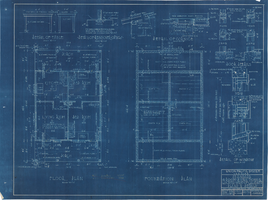
Los Angeles & Salt Lake Railroad Company standard four room bunk house west of Caliente, Nevada: architectural drawing
Date
Archival Collection
Description
From Union Pacific Railroad Collection (MS-00397). The scales are noted in the drawing. The bottom corner states, "Union Pacific System L.A. & S.L.R.R. Standard 4 Room Bunkhouse Located West Of Caliente Plans & Details. Asst. Chief Engineer's Office Los Angeles Calif. Drawn By A.J.R. Traced By A.J.R. Checked By F.W.G. Date. Dec. 22nd' 26. Scales As Shown. Revised March 17, 1928. Drawing No 15659-A".
Image
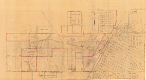
Map of Las Vegas showing areas owned by the Union Pacific Railroad Company, water pipes and other water utilities, circa 1942
Date
Archival Collection
Description
Image
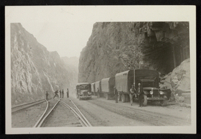
Photograph of trucks and railroad tracks at Hoover Dam construction site, circa 1930-1935
Date
Archival Collection
Description
Image
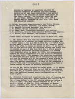
Meeting minutes from committee considering the question of serving railroad company facilities in Las Vegas, July 8, 1952
Date
Archival Collection
Description
Las Vegas General Attorney Calvin Cory determined that the 2.5 CFS from Well No. 1 represents a vested right. Committee discusses drilling another well on the shop grounds to increase production to the point where they can use the 2.5 CFS and protect water rights.
Text
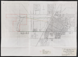
Conveyance of water owned by LVLWC through pipelines owned by Los Angeles and Salt Lake Railroad Company (LASLRRC)
Date
Archival Collection
Description
Mixed Content
Hotels and wooden buildings, windmill, railroad water tower, and cattle yard, Ralston, Nevada, undated
Level of Description
Archival Collection
Collection Name: Art Rader Photograph Collection on Nevada Railroads
Box/Folder: Folder 01
Archival Component
San Pedro Los Angeles and Salt Lake Railroad Company (SPLASLC) taxes, 1903-1905
Level of Description
Archival Collection
Collection Name: Union Pacific Railroad Collection
Box/Folder: Box 28
Archival Component
