Search Results
Mines and Mills, 1881-1911
Level of Description
Series
Scope and Contents
Materials contain photographs of mines, mining operations, and mills in Nevada from 1881 to 1911, including mines in Tuscarora, Sagebrush, Potosi, Delamar, Tonopah, Gold Hill, Virginia City, Eureka, and Searchlight.
Archival Collection
Elbert Edwards Photograph Collection
To request this item in person:
Collection Number: PH-00214
Collection Name: Elbert Edwards Photograph Collection
Box/Folder: N/A
Collection Name: Elbert Edwards Photograph Collection
Box/Folder: N/A
Archival Component
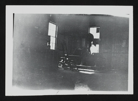
Mining equipment in Esmeralda County: photographic print
Date
1900 (year uncertain) to 1939 (year uncertain)
Archival Collection
Description
Mining equipment stored inside a building at Revert Divide Mine in Esmeralda County, Nevada circa early 1900s.
Image
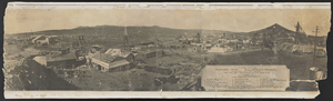
Photograph of Mohawk Mine, Goldfield (Nev.), 1906
Date
1906
Archival Collection
Description
Mohawk Mine during production in Goldfield, Nevada. Inscription below image reads: "General View of the Mohawk Mine, Goldfield, Nevada. The Greatest Gold Mine Known. First Sixy Days Operation, $6,000,000 Production. Copyright No. 4200 P. E. Larson Photos. Goldfield, Esmeralda County, Nevada. 1906." Listed underneath are the 19 different mine and lease sites that make up the Mohawk Mine area.
Image
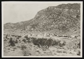
Potosi Mining Camp: photographic print
Date
1917
Archival Collection
Description
From the Elizabeth Harrington Photograph Collection (PH-00291). Inscription with image reads: "Potosi mining camp 1917"
Image
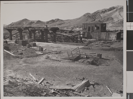
Photograph of Three Kids Mine, 1972
Date
1972
Archival Collection
Description
Handwritten description provided on back of image: "Three Kids Mine, 1972."
Image
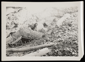
Photograph of mine entrance, Sheep Mountain, 1931
Date
1931
Archival Collection
Description
Entrance to mine on the Sheep Mountain Range in Nevada. For more mine images at the Sheep Range, see 0123 0178-0180.
Image
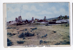
Postcard of the Mohawk Mine, Goldfield (Nev.), 1907
Date
1907
Archival Collection
Description
Caption: The Great Mohawk Mine, Goldfield, Nev.
Image
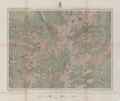
Map of economical features of Southwest Colorado, San Juan mining region, circa 1877
Date
1872 to 1880
Description
37 x 49 cm. Relief shown by hachures and spot heights. "Atlas sheet no. 61(C)." "Expeditions of 1874 & 1875 under the command of 1st. Lieut. Geo. M. Wheeler, Corps of Engineers, U.S. Army." "Louis Nell, del." "By order of the honorable the Secretary of War." "Under the direction of Brig. General A. A. Hunphreys, Chief of Engineers, U. S. Army." Original publisher: U.S. Geographical Surveys West of the 100th Meridian, Scale: 1 inch to 2 miles or 1: 126720.
Image
Maps of Eureka Mining and Divide Mining districts, 1900 to 1909
Level of Description
Item
Archival Collection
Raymond Brooks Papers on Mining
To request this item in person:
Collection Number: MS-01153
Collection Name: Raymond Brooks Papers on Mining
Box/Folder: Box 06
Collection Name: Raymond Brooks Papers on Mining
Box/Folder: Box 06
Archival Component
McCarthy Brothers Mines and Mining correspondence, Tonopah, Nevada, 1916
Level of Description
File
Archival Collection
UNLV University Libraries Collection on Nevada Mining
To request this item in person:
Collection Number: MS-00011
Collection Name: UNLV University Libraries Collection on Nevada Mining
Box/Folder: Box 01
Collection Name: UNLV University Libraries Collection on Nevada Mining
Box/Folder: Box 01
Archival Component