Search Results
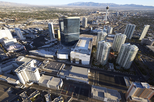
Casino Projects on the Las Vegas Strip from the Air, Las Vegas, Nevada: digital photograph
Date
Archival Collection
Description
Image
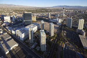
Casino Projects on the Las Vegas Strip from the Air, Las Vegas, Nevada: digital photograph
Date
Archival Collection
Description
Image
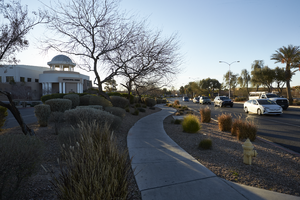
North Las Vegas Municipal Court building off Las Vegas Boulevard and Civic Center Drive in North Las Vegas, Nevada: digital photograph
Date
Archival Collection
Description
From the UNLV University Libraries Photographs of the Development of the Las Vegas Valley, Nevada (PH-00394). Part of the collection documents the entire 19 mile length of the north/south Eastern Avenue / Civic Center Drive alignment. This photograph was captured in the section of Civic Center Drive between Las Vegas Boulevard and Lake Mead Boulevard.
Image
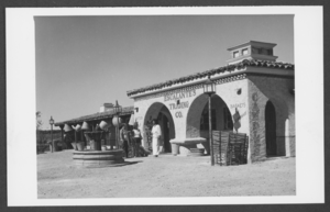
Photograph of Old Vegas, Las Vegas, 1980
Date
Archival Collection
Description
Image
University of Nevada, Las Vegas Commencement Programs and Graduation Lists
Identifier
Abstract
The University of Nevada, Las Vegas Commencement Programs and Graduate Lists collection (1953-2021) contains graduation programs, final graduation lists, planning files for commencement ceremonies for the University of Nevada, Las Vegas (UNLV). The planning files contain correspondence, itineraries for ceremony days, and photographs.
Archival Collection
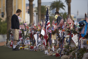
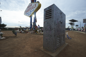
A man looks over items left at the 1 October memorial located at the Welcome to Las Vegas sign, looking north-northwest in Las Vegas, Nevada: digital photograph
Date
Archival Collection
Description
Following the October 1, 2017 killing of 58 people at the Route 91 Harvest Music Festival on the Las Vegas Strip, the Las Vegas community responded in a variety of ways. This series of photographs document the impromptu memorial created at the Welcome to Las Vegas sign.
Image
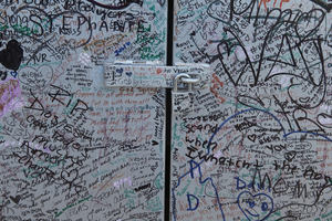
Messages, left as part of the 1 October memorial, cover a utility box near the Welcome to Las Vegas sign, looking east in Las Vegas, Nevada: digital photograph
Date
Archival Collection
Description
Following the October 1, 2017 killing of 58 people at the Route 91 Harvest Music Festival on the Las Vegas Strip, the Las Vegas community responded in a variety of ways. This series of photographs document the impromptu memorial created at the Welcome to Las Vegas sign.
Image
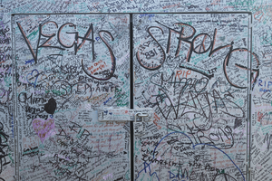
Messages, left as part of the 1 October memorial, cover a utility box near the Welcome to Las Vegas sign, looking southeast in Las Vegas, Nevada: digital photograph
Date
Archival Collection
Description
Following the October 1, 2017 killing of 58 people at the Route 91 Harvest Music Festival on the Las Vegas Strip, the Las Vegas community responded in a variety of ways. This series of photographs document the impromptu memorial created at the Welcome to Las Vegas sign.
Image

Messages, left as part of the 1 October memorial, cover a light fixture at the Welcome to Las Vegas sign, looking south-southwest in Las Vegas, Nevada: digital photograph
Date
Archival Collection
Description
Following the October 1, 2017 killing of 58 people at the Route 91 Harvest Music Festival on the Las Vegas Strip, the Las Vegas community responded in a variety of ways. This series of photographs document the impromptu memorial created at the Welcome to Las Vegas sign.
Image