Search the Special Collections and Archives Portal
Search Results
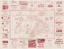
Map of the city of Las Vegas, 1953
Date
1953
Description
24 x 38 cm. on sheet 43 x 56 cm., folded to 28 x 13 cm. Includes advertisements for Las Vegas businesses. Advertisements for Las Vegas businesses, inset map of North Las Vegas, and index on verso. Copyright held by Redwood Pub. Co. Includes inset map of the Strip (U.S. 91 or Los Angeles Highway). Map is irregularly shaped. Original publisher: Redwood Pub. Co..
Image
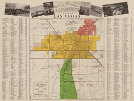
General map of Las Vegas, Nevada, circa 1957
Date
1955 to 1959
Description
'Compiled and issued by the Campbell Realty Company.' At top pf map: ' Greater Las Vegas.' Shows names of housing tracts and locations of hotels and motels on the Las Vegas Strip. Includes indexes and photographs of local recreation and attractions. Originally published by Campbell Realty
distributed by Las Vegas Nevada Chamber of Commerce . Scale (ca. 1:39,000. 1 in. to approx. 3,250 ft.].
distributed by Las Vegas Nevada Chamber of Commerce . Scale (ca. 1:39,000. 1 in. to approx. 3,250 ft.].
Text
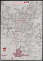
Map of metropolitan Las Vegas, Nevada, 1971
Date
1971
Description
At top of map: 'Avis Rent a Car System.' 'Copyright The H.M.Gousha Company... San Jose, Calif.' '8-SS-1044-S.' Scale [ca. 1:43,718]. 1 in. equals approx 0.69 miles. On verso: map of 'Las Vegas [and] Lake Mead Recreational Area, 1971 edition'; map of McCarran International Airport ('1274-S'); and list of Avis Rent A Car locations. H.M. Gousha Co.
Text
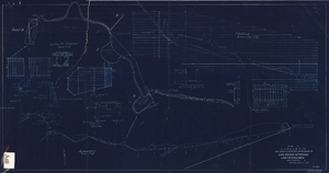
Blueprint showing proposed improvement of Las Vegas Springs, Las Vegas, Nevada, September 21, 1916
Date
1916-09-21
Archival Collection
Description
'Exhibit A'. 'Approved Sept. 21, 1916.' '2-N-1719' handwritten in lower right corner. 'W.E.J."--Lower left corner. "L-44 - 50 to 61. T-75 - 17 & 46"--Upper left corner. Includes discharge figures and plans for improvements to springs. Scale [ca. 1:240]. 1 in. to 20 feet. -- Scale [ca. 1:2,400]. 1 in. to 200 ft. Vertical scale [ca. 1:48]. 1 in. to 4 feet. -- Scale [ca. 1:4,800]. 1 in. to 100 feet. 1 map. Contents: Detail at springs -- Profile -- Alignment.
Image

Topographic map of Nevada-California, Las Vegas quadrangle, 1951
Date
1951
Description
'Edition of Mar. 1908, reprinted 1951.' 'E.M. Douglas, geographer in charge; Topography and triangulation by R.H. Chapman, B.D. Stewart, J.E. Blackburn, and D.F.C. Moor. Surveyed in 1906-1907.' Scale 1:250,000 ; polyconic proj. (W 116°00--W 115°00/N 37°00--N 36°00). Relief shown by contours and spot heights. Title in lower-right corner: Nev.-Calif., Las Vegas. Contour interval 100 feet. Datum is mean sea level. U.S. Geological Survey
Image
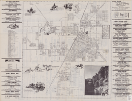
Street map of the city of Las Vegas, North Las Vegas, the "Strip", 1955
Date
1955
Description
41 x 38 cm., folded to 28 x 15 cm. Panel title: Welcome map, greater Las Vegas area. Includes inset map of Meikle Manor subdivision. Includes list of churches in Las Vegas, mileages from Las Vegas to other cities in the Southwest and notes. Helldorado ed. 1955. Map is irregularly shaped. Index and advertisements on verso. Original publisher: Adco Publishing Co..
Image
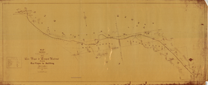
Map showing location of the Las Vegas & Tonopah Railroad from Las Vegas to Bullfrog, Nevada, 1906
Date
1906
Archival Collection
Description
'Office of Chief Engineer' printed on map above date.
Image
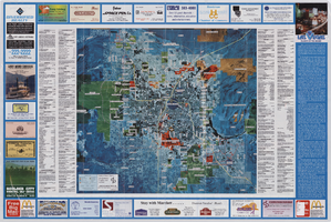
Aerial map of the Las Vegas Valley, with map of Las Vegas, 1992
Date
1992
Description
2 maps on 1 sheet : both sides, col. ; 47 x 51 cm. and 54 x 71 cm. on sheet 61 x 91 cm. Photomap. Includes text about Las Vegas, list of businesses with coordinates for map on verso, and advertisements. On verso: Bird's-eye view map of a section of unincorporated Las Vegas east of the Strip between Charleston and Sunset oriented with north to left and drawn by Jack Tavenner in 1992. Shows locations of schools, lists Boulder City merchants, and includes advertisements. Original Publisher: Landiscor Aerial Photo
Image
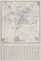
Street map of Las Vegas and vicinity, 1960
Date
1960
Description
43 x 40 cm., folded to 18 x 9 cm. Panel title: Las Vegas and vicinity map. Includes index. Text with facts about Las Vegas, photographs of Las Vegas and nearby tourist attractions and maps of Henderson, Boulder City and downtown Las Vegas on verso. Library's copy 2 has notes handwritten in black ink. Original publisher: Thomas Bros. Maps.
Image
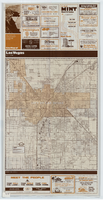
City map of Las Vegas, 1973
Date
1905-05-26
Description
Color; 55 x 45 cm., on sheet 95 x 47 cm., folded to 24 x 10 cm. Panel title: Las Vegas city map. Copyright held by Cardinal Publishing Company. Relief shown by hachures. Includes illustrations and advertisements. Index, text, illustrations, advertisements, and map of "Lake Mead National Recreation Area, lower basin section" on verso. Original publisher: Cardinal Publishing Company.
Image
Pagination
Refine my results
Content Type
Creator or Contributor
Subject
Archival Collection
Digital Project
Resource Type
Year
Material Type
Place
Language
Records Classification
