Search the Special Collections and Archives Portal
Search Results
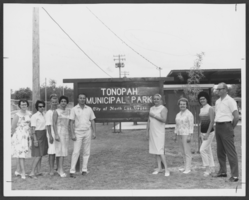
Photograph of North Las Vegas Women's Club, North Las Vegas, July 22, 1965
Date
Archival Collection
Description
Image
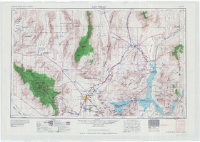
Topographic map of the Las Vegas Valley area, 1959
Date
Description
Image

Map of Las Vegas and vicinity, Clark County, Nevada, December 1954
Date
Description
Image

Topographic map of groundwater in the southeast quadrangle of Las Vegas, Nevada, 1980
Date
Description
Text

Map of Las Vegas, Nevada and surrounding Bureau of Land Management areas to the west and north, 1994
Date
Description
Text
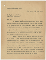
Letter from Walter R. Bracken (Las Vegas) to F. H. Knickerbocker (Los Angeles), July 1, 1936
Date
Archival Collection
Description
Letter on the water situation in Las Vegas during a water shortage and status of water supply to the Stewart burial plot and the Las Vegas Ranch.
Text
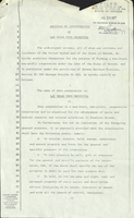
Articles of Incorporation for Las Vegas Pops Orchestra, July 28, 1977
Date
Archival Collection
Description
The articles of incorporation for the Las Vegas Pops Orchestra were filed with the State of Nevada in 1977, establishing the group as a non-profit entity with a board of trustees made up of Hyman Gold, Ruth Gold, Fred Franke, Roxy Gyeer and Thelma Dicerto.
Text
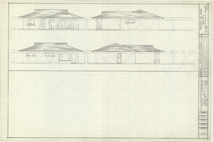
Architectural drawings of residential home in Las Vegas, Nevada, exterior elevations, 1955
Date
Archival Collection
Description
Drawings of exterior elevations of a ranch-style residential home in the Greater Las Vegas development in Las Vegas, Nevada. Handwritten underneath drawings at right: "Plan 14C - Elev. C."
Site Name: Greater Las Vegas
Image
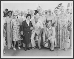
Photograph of Las Vegas Rose Garden Senior Citizens Club, July 2, 1978
Date
Archival Collection
Description
Image
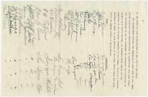
Petition by citizens of Las Vegas to Board of City Commissioners (Las Vegas) requesting adequate water supply, filed July 7, 1927
Date
Archival Collection
Description
Petition signed by citizens and taxpayers of the city of Las Vegas requesting the Board of City Commissioners of Las Vegas to take action to secure an adequate water supply for the residents of the Original Townsite of Las Vegas. Document lists 29 signatures and is stamped with a filing date of July 7, 1927.
Text
