Search Results
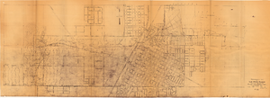
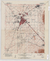
Topographic map of Las Vegas Rancho, showing location of wells and water lines, Las Vegas, Nev., October 18, 1946
Date
1946-10-18
Archival Collection
Description
'May 1, 1940. Revised Oct. 18, 1946.' 'F-225.' Relief shown by contours. Scale [ca. 1:7,200] 1 in.=600 feet.
Image
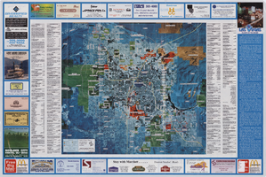
Street map of Las Vegas, 1966
Date
1966
Description
1966 ed. Color; 56 x 43 cm., folded to 23 x 10 cm. Panel title: Street map of Las Vegas and vicinity. On bottom of panel: Humble Oil & Refining Company. Index, photographs of Las Vegas scenes and nearby tourist attractions and map titled Lake Mead National Recreation Area, lower basin section on verso. Original publisher: H. M. Gousha Company.
Image
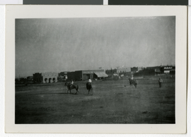
Photograph of rodeo festivities in Las Vegas, Nevada, July 4, 1910
Date
1910-07-04
Archival Collection
Description
Description included with photograph: "1910 - July 4th front up freight house; Rodeo Arizona Club in background.' [Building at left: Las Vegas Land and Water Co.]" The Las Vegas Drug Store is seen in the center of the photo.
Image
The Wheel of Rotary Las Vegas Rotary Club newsletter, July 14, 1949
Date
1949-07-14
Archival Collection
Description
Newsletter issued by the Las Vegas Rotary Club
Text

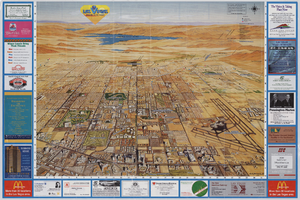
Street map of greater Las Vegas, Nevada, 1965-1966
Date
1965 to 1966
Description
Rev. 1965-1966 ed. 55 x 42 cm., folded to 29 x 12 cm. Panel title: Front Boy's official street map. Relief shown by spot heights. Copyright held by Russell A. Meador. Includes notes, quotations and indexes. Street index on verso. "Detailed guide of North Las Vegas, Las Vegas, Paradise Valley, and vicinity." Original publisher: Meador, Russell A.
Image
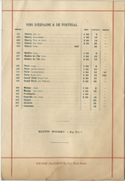
Restaurant Paillard, alcoholic beverage list, July 1896
Date
1896-07
Archival Collection
Description
Menu insert: Spirits lists; Wine lists Restaurant: Restaurant Paillard Location: 38 Boulevard des Italiens et 2 Chaussée d'Antin, Paris, France
Text
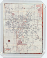
Topographic map of the Las Vegas Valley Area, 1952
Date
1952
Description
Scale 1:62,500 ; polyconic proj ; 1 map : col. ; 45 x 36 cm.; Relief shown by contours and spot heights. Contour interval 20 ft. ; Includes quadrangle location map ; Nevada 15 minute series (topographic) ; Fifteen minute series (topographic) Nevada ; Geological Survey
Image
Publications: Las Vegas Activist, 2001 July
Level of Description
File
Archival Collection
Dennis McBride Collection on LGBTQ Las Vegas, Nevada
To request this item in person:
Collection Number: MS-00802
Collection Name: Dennis McBride Collection on LGBTQ Las Vegas, Nevada
Box/Folder: Box 22
Collection Name: Dennis McBride Collection on LGBTQ Las Vegas, Nevada
Box/Folder: Box 22
Archival Component