Search the Special Collections and Archives Portal
Search Results
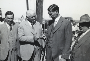
Photograph of Carl Gray handing Ray Lyman Wilbur the first railroad spur spike for Hoover Dam, circa early 1930s
Date
1930 to 1933
Archival Collection
Description
Black and white image of several prominent figures, in front of a crowd outdoors. From left to right: Governor Balzar of Nevada; Carl Gray, President of Union Pacific Railroad Company; Ray Lyman Wilbur, Secretary of the Interior; Governor of Colorado (possibly Edwin C. Johnson). Gray is handing Lyman the first spike to be driven for the spur line to Boulder Dam. Note: Boulder Dam was officially renamed Hoover Dam in 1947.
Image
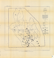
Map showing chemical diagrams representing quality of water in Clark and Nye counties, Nevada, 1963
Date
1963
Description
'T.E. Eakin, S.L. Schoff, and P. Cohen, 1963.' 'Department of the Interior, United States Geological Survey, TEI-833.' 'Prepared in cooperation with the U.S. Atomic Energy Commission.' Scale 1:500,000 (W 117°00´--W 115°00´/N 38°30´--N 36°30´). Originally published as figure 3 in Regional hydrology of a part of southern Nevada : a reconnaissance / by Thomas E. Eakin, Stuart L. Schoff, and Philip Cohen, published by the U.S. Geological Survey in 1963 as number 833 of the Trace elements investigation report.
Image
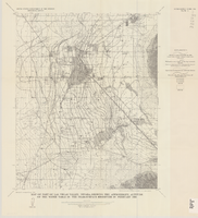
Map of part of Las Vegas Valley, Nevada, showing the approximate altitude of the water table in the near-surface reservoir in February 1956
Date
1965
Description
Genre/Form: Thematic maps. Scale 1:62,500 (W 115°15´--W 115°00´/N 36°15´--N 36°00´). 1 map ; 45 x 36 cm. Series: Water-supply paper (Washington, D.C.) ; 1780. Relief shown by contours. Originally published as plate 8 of Available water supply of the Las Vegas ground-water basin, Nevada, by Glenn T. Malmberg, published by the Geological Survey in 1965 as its Water-supply paper 1780. Includes township and range lines. Interior, Geological Survey
Image
Pagination
Refine my results
Content Type
Creator or Contributor
Subject
Archival Collection
Digital Project
Resource Type
Year
Material Type
Place
Language
Records Classification

