Search the Special Collections and Archives Portal
Search Results
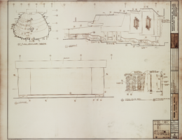
Architectural drawing of MGM Grand Hotel (Las Vegas), headliner theatre, September 11, 1972
Date
Archival Collection
Description
Elevations and typical railing details for the headliner theatre in the MGM Grand Hotel in Las Vegas, Nevada. Includes revisions and key plan. Printed on mylar. The MGM Grand Hotel was sold to Bally's Corporation to become Bally's Las Vegas in 1985. Berton Charles Severson, architect; Brian Walter Webb, architect; C. L. Leviste, delineator; Taylor Construction Co., Interior Design Division.
Site Name: MGM Grand Hotel
Address: 3645 Las Vegas Boulevard South, Las Vegas, NV
Image
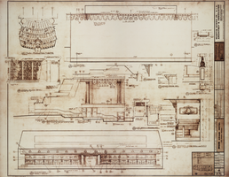
Architectural drawing of MGM Grand Hotel (Las Vegas), production theatre, September 11, 1972
Date
Archival Collection
Description
Elevations and detailed drawings of woodwork in the MGM Grand Hotel production theatre. Includes revisions, and key plan. Printed on mylar. The MGM Grand Hotel was sold to Bally's Corporation to become Bally's Las Vegas in 1985. Berton Charles Severson, architect; Brian Walter Webb, architect; A. S. Bautista, delineator; Taylor Construction Co., Interior Design Division.
Site Name: MGM Grand Hotel
Address: 3645 Las Vegas Boulevard South, Las Vegas, NV
Image
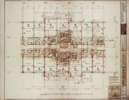
Architectural drawing for MGM Grand Hotel (Las Vegas), high-rise rooms floor plans, April 3, 1972
Date
Archival Collection
Description
Typical floor plans for high-rise tower rooms in the MGM Grand Hotel. Drawn by W. O. Includes key plan and revisions. Printed on mylar. The MGM Grand Hotel was sold to Bally's Corporation to become Bally's Las Vegas in 1985. Berton Charles Severson, architect; Brian Walter Webb, architect; Taylor Construction Co., Interior Design Division.
Site Name: MGM Grand Hotel
Address: 3645 Las Vegas Boulevard South, Las Vegas, NV
Image
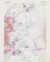
Topographic map of the northeast quadrangle of the metropolitan Las Vegas, Nevada area, 1973
Date
Description
Image
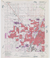
Topographic map of the northwest quadrangle of the metropolitan Las Vegas, Nevada area, 1973
Date
Description
Image
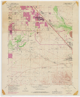
Topographic map of the southeast quadrangle of the metropolitan Las Vegas, Nevada area, 1973
Date
Description
Image
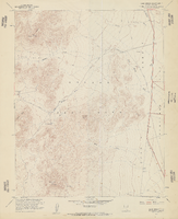
Topographic map of Cane Spring, Nevada quadrangle, 1961
Date
Description
For sale by the U.S. Geological Survey
Image
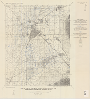
Map of part of Las Vegas Valley, Nevada, showing the approximate piezometric surface in 1912
Date
Description
1780. Originally published as plate 7 of Available water supply of the Las Vegas ground-water basin, Nevada, by Glenn T. Malmberg, published by the Geological Survey in 1965 as its Water-supply paper 1780.
Image
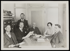
Photograph of board meeting for land development, Overton (Nev.), 1925-1935
Date
Archival Collection
Description
Image

