Search the Special Collections and Archives Portal

Search Results
Display    Results Per Page
Displaying results 3731 - 3740 of 4493

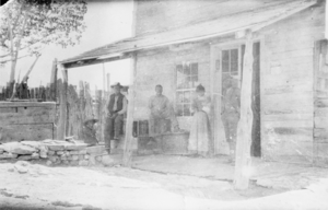
Unidentified individuals in front of the Pahrump Store in Nevada: photographic print

Date

1920

Description

From the Nye County, Nevada Photograph Collection (PH-00221) -- Series IV. Pahrump, Nevada -- Subseries IV.G. Brown Family (Tecopa-Pahrump). Believed to be the old Pahrump Store. Until a window was constructed to the left of the double doors, a post office was housed there, on the left side of the building’s interior. Individuals pictured are unidentified. Woman may be Clara Lee, daughter of Phi Lee.

Image

Fred A. and Clara G. Monson Papers

Identifier

MS-00207

Abstract

The Fred A. and Clara G. Monson Papers (1860s-1976) consist of photographs, postcards, scrapbooks, greeting and sympathy cards, and documents related to Fred Monson's employment and the Monson's Las Vegas "Rock House" residence.

Archival Collection
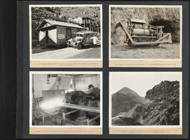
Warren A. Bechtel Album of Hoover Dam: photographic print

Date

1971-07-01

Description

p.7 #969 First-aid station and ambulance located at river camp above upper portals. Similar hospital is maintained at lower portals. Mar, 8, 1932. p.7 #918 Interior of one of many drill sharpening stations, showing forge and Ingersoll-Rand drill sharpener. Feb. 15, 1932. p.7 #974 Caterpillar 60 with bull-dozer in front and cow-dozer aft, used extensively for moving muck. Mar. 8, 1932. p.7 #946 Two levels of highway which will cross top of the dam. Note the rubble stone masonry retaining wall. High-level concrete mixing plant will be located in the draw in foreground. Mar. 2, 1932.

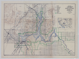
Topographic map of Boulder Canyon Project, Boulder Dam area, 1940

Date

1940

Description

Scale [ca. 1:221,760. 1 in. to approx. 3.5 miles] ; 1 map : col. ; 51 x 71 cm ; Relief shown by contours and spot heights ; Includes township and range grid ; "Map no. 40-40" ; Includes index map ; Shows power lines, triangulation stations, boundary monuments, roads, telephone lines, mines, bench marks, etc. ; U.S. Dept. of the Interior, Bureau of Reclamation

Image

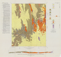
Geologic map of the Plutonium Valley quadrangle, Nye and Lincoln counties, Nevada, 1965

Date

1965

Description

58 x 46 cm., on sheet 77 x 83 cm., folded in envelope 30 x 24 cm. Relief shown by contours and spot heights. "Geology mapped in 1961." Includes description of map units, col. cross section, and quadrangle location map. "Prepared in cooperation with the U. S. Atomic Commission." Original publisher: Interior, Geological Survey, Series: Geologic quadrangle map GQ, Scale: 1:24 000.

Image

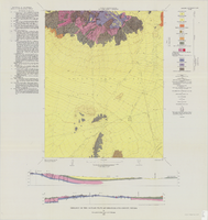
Geology of the Jackass Flats quadrangle, Nye County, Nevada, 1964

Date

1964

Description

58 x 47 cm., on sheet 86 x 81 cm., folded in envelope 30 x 24 cm. Relief shown by contours and spot heights. "Geology mapped in 1961." Includes description of map units, 2 col. cross sections, and quadrangle location map. "Prepared in cooperation with the U. S. Atomic Commission." Original publisher: Interior, Geological Survey, Series: Geologic quadrangle map GQ, Scale: 1:24 000.

Image