Search the Special Collections and Archives Portal
Search Results
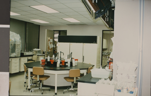
Photograph of a science classroom, University of Nevada, Las Vegas, circa 1991-1992
Date
1991 (year approximate)
Archival Collection
Description
A science classroom with equipment.
Image
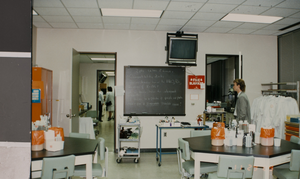
Photograph of a classroom, University of Nevada, Las Vegas, circa 1991-1992
Date
1991 (year approximate)
Archival Collection
Description
Classroom in the Rod Lee Bigelow Health Sciences (BHS) building, at the University of Nevada, Las Vegas (UNLV).
Image
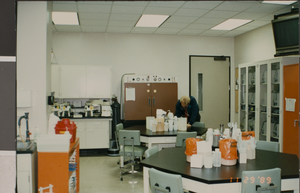
Photograph of a classroom, University of Nevada, Las Vegas, circa 1991-1992
Date
1991 (year approximate)
Archival Collection
Description
Classroom in the Rod Lee Bigelow Health Sciences (BHS) building, at the University of Nevada, Las Vegas (UNLV).
Image
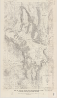
Map of the Las Vegas ground-water basin, Clark, Nye, and Lincoln Counties, Nevada, 1965
Date
1965
Description
At top of map: 'United States Department of the Interior, Geological Survey. Water-supply paper 1780, plate 1.' At bottom of map: 'Base from Army Map Service sheets NJ 11-9, NJ 11-12, and NI 11-3 (1947).' 'Boundary between bedrock and alluvium in Clark County, Nev., compiled by Ben Boyer, E. H. Pampeyan and C. R. Longwell. In Lincoln and Nye Counties, contact determined from aerial photographs.' 'Interior--Geological Survey, Washington, D.C.--1965--W63358.' Includes township and range lines.Relief shown by contours. Thematic map. Scale 1:250,000 (W 116°--W 114°45´/N 37°00´--N 35°30´). Series: Water-supply paper (Washington, D.C.), 1780. Originally published as plate 1 of Available water supply of the Las Vegas ground-water basin, Nevada, by Glenn T. Malmberg, published by the Geological Survey in 1965 as its Water-supply paper 1780.
Image
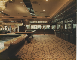
Photograph of the cashier's cage at the Stardust Hotel and Casino (Las Vegas), circa early 1970s
Date
1970 to 1975
Archival Collection
Description
Stardust cashier's cage and craps area before renovations made in the mid 1970s.
Site Name: Stardust Resort and Casino
Address: 3000 Las Vegas Boulevard South
Image
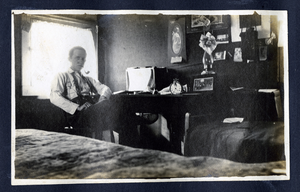
Photograph of C. A. Earle Rinker sitting at desk in a cottage, Goldfield (Nev.), early 1900s
Date
1900 to 1925
Archival Collection
Description
Photograph of C. A. Earle Rinker sitting at desk in a cottage, Goldfield (Nev.), early 1900s
Image
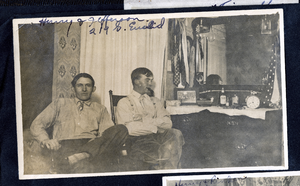
Photograph of Dalta Hurry and Raymond Jefferson, Goldfield (Nev.), early 1900s
Date
1900 to 1925
Archival Collection
Description
Caption: Hurry & Jefferson 219 S. Euclid
Image
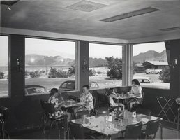
Photograph of guests in the restaurant of the Lake Mead Lodge, Nevada, circa 1940s to 1950s
Date
1940 to 1959
Archival Collection
Description
A black and white image of guests sitting in restaurant at the Lake Mead Lodge. Lake Mead is visible through the windows.
Image
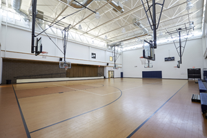
Photograph of Desert Torah Academy gymnasium, Las Vegas (Nev.), September 22, 2016
Date
2016-09-22
Archival Collection
Description
The gym inside the Desert Torah Academy on the Robert Cohen Educational Campus at 1312 Vista Drive.
Image
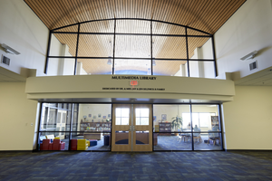
Photograph of Library at Desert Torah Academy, Las Vegas (Nev.), September 22, 2016
Date
2016-09-22
Archival Collection
Description
The Multimedia Library inside the Desert Torah Academy on the Robert Cohen Educational Campus at 1312 Vista Drive.
Image
Pagination
Refine my results
Content Type
Creator or Contributor
Subject
Archival Collection
Digital Project
Resource Type
Year
Material Type
Place
Language
Records Classification
