Search the Special Collections and Archives Portal
Search Results
Harbor reports - New York City map, 1925
Level of Description
Archival Collection
Pagination
- Previous page ‹‹
- Page 3
Archival Component
New York Mine, Silver City, Nevada, undated
Level of Description
Archival Collection
Pagination
- Previous page ‹‹
- Page 3
Archival Component
New York Mine, Silver City, Nevada, undated
Level of Description
Archival Collection
Pagination
- Previous page ‹‹
- Page 3
Archival Component
New York Mine, Silver City, Nevada, undated
Level of Description
Archival Collection
Pagination
- Previous page ‹‹
- Page 3
Archival Component
New York Mine, Silver City, Nevada, undated
Level of Description
Archival Collection
Pagination
- Previous page ‹‹
- Page 3
Archival Component

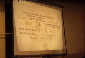
Slide presentation from a hearing at a City Hall in Nevada: photographic slide
Date
Archival Collection
Description
From the Sister Klaryta Antoszewska Photograph Collection (PH-00352). The presentation slide reads, "Total announced tests and radiation measured off the test range complex. Total above-ground tests = 126. Total sub0surface tests = 413. Total tests = 539. Number measured off the test range complex of above-ground tests = 89. Number measured off the test range complex of sub-surface tests = 40. Total number measured off the test range complex = 129."
Image

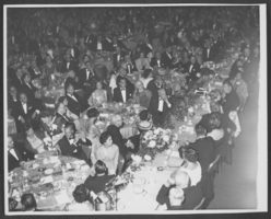
Photograph of a formal dinner at the Hotel Astor, New York City, 1958
Date
Archival Collection
Description
Image

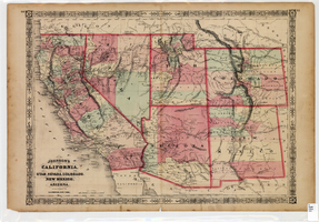
Map of California, Utah, Nevada, Colorado, New Mexico and Arizona, 1864
Date
Description
Text
Harrah's Grand, Atlantic City, New Jersey, 2001
Level of Description
Archival Collection
Pagination
- Previous page ‹‹
- Page 3
Archival Component

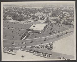
Aerial photograph of Civic Center Drive and North Las Vegas City Hall, May 23, 1970
Date
Archival Collection
Description
Image
