Search Results

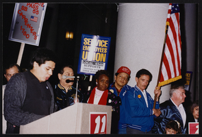
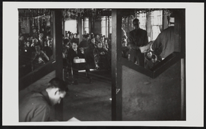
March to Los Angeles: L.A. City Hall, Culinary Union, 1992 (folder 1 of 1), image 21
Date
1992
Description
Arrangement note: Series I. Demonstrations, Subseries I.B. Other Demonstrations and Strikes
Image
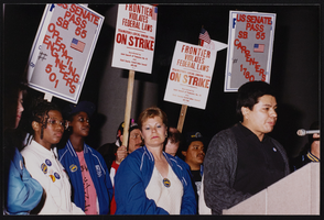
March to Los Angeles: L.A. City Hall, Culinary Union, 1992 (folder 1 of 1), image 22
Date
1992
Description
Arrangement note: Series I. Demonstrations, Subseries I.B. Other Demonstrations and Strikes
Image
March to Los Angeles: L.A. City Hall, Culinary Union, 1992 (folder 1 of 1), image 23
Date
1992
Description
Arrangement note: Series I. Demonstrations, Subseries I.B. Other Demonstrations and Strikes
Image

March to Los Angeles: L.A. City Hall, Culinary Union, 1992 (folder 1 of 1), image 24
Date
1992
Description
Arrangement note: Series I. Demonstrations, Subseries I.B. Other Demonstrations and Strikes
Image

March to Los Angeles: L.A. City Hall, Culinary Union, 1992 (folder 1 of 1), image 25
Date
1992
Description
Arrangement note: Series I. Demonstrations, Subseries I.B. Other Demonstrations and Strikes
Image

March to Los Angeles: L.A. City Hall, Culinary Union, 1992 (folder 1 of 1), image 26
Date
1992
Description
Arrangement note: Series I. Demonstrations, Subseries I.B. Other Demonstrations and Strikes
Image
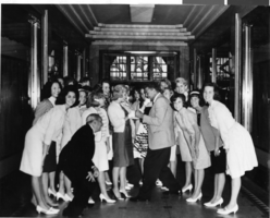
Photograph of Las Vegas High School Rhythmettes and Jack Dempsey, New York City, June 1964
Date
1964-06
Archival Collection
Description
The Las Vegas High School Rhythmettes pose with Jack Dempsey in his restaurant in New York City, New York.
Image
General Motors 1964 New York World's Fair exhibit: reception hall ceiling plan and interior perspective sketch, 1960s
Level of Description
File
Archival Collection
Frank Reynolds Professional Papers
To request this item in person:
Collection Number: MS-00926
Collection Name: Frank Reynolds Professional Papers
Box/Folder: Roll 29 (Restrictions apply)
Collection Name: Frank Reynolds Professional Papers
Box/Folder: Roll 29 (Restrictions apply)
Archival Component
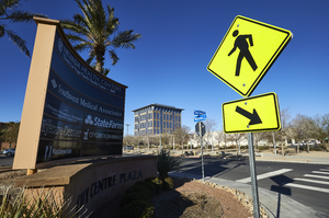
The City Centre Plaza sign on the corner of North McDaniel Street and Civic Center Drive with City Hall in background, looking northwest in North Las Vegas, Nevada: digital photograph
Date
2019-02-06
Archival Collection
Description
From the UNLV University Libraries Photographs of the Development of the Las Vegas Valley, Nevada (PH-00394). Part of the collection documents the entire 19 mile length of the north/south Eastern Avenue / Civic Center Drive alignment. This photograph was captured in the section of Civic Center Drive between Las Vegas Boulevard and Lake Mead Boulevard.
Image
Volunteers of the Civilian Conservation Corps celebrating Christmas in the recreation hall of their camp in Boulder City, Nevada: photographic print
Date
1939-12
Archival Collection
Description
From the T.M. Parsons Photograph Collection (PH-00258) -- Recreation hall at camp number NP-6, Company 2536 Former Six Companies'.
Image