Search Results
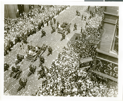
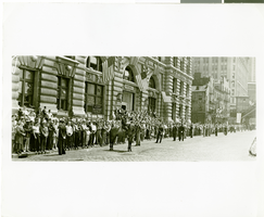
Photograph of a parade for Howard Hughes, New York City, July 15, 1938
Date
1938-07-15
Archival Collection
Description
The view of a crowd consisting of thousands of people who attended a parade that celebrated Howard Hughes completion of his flight Around the World in New York City.
Image
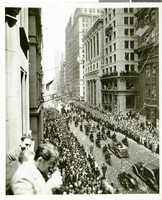
Photograph of a parade for Howard Hughes, New York City, July 15, 1938
Date
1938-07-15
Archival Collection
Description
The view of a crowd consisting of thousands of people who attended a parade that celebrated Howard Hughes completion of his flight Around the World in New York City.
Image
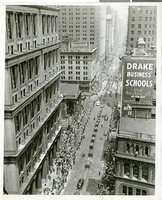
Photograph of a parade for Howard Hughes, New York City, July 15, 1938
Date
1938-07-15
Archival Collection
Description
The view of a crowd consisting of thousands of people who attended a parade that celebrated Howard Hughes completion of his flight Around the World in New York City.
Image
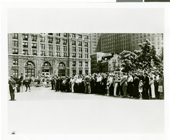
Photograph of a parade for Howard Hughes, New York City, July 15, 1938
Date
1938-07-15
Archival Collection
Description
The view of a crowd consisting of thousands of people who attended a parade that celebrated Howard Hughes completion of his flight Around the World in New York City.
Image
Photograph of a parade for Howard Hughes, New York City, July 15, 1938
Date
1938-07-15
Archival Collection
Description
The view of a crowd consisting of thousands of people who attended a parade that celebrated Howard Hughes completion of his flight Around the World in New York City.
Image
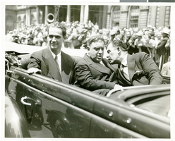
Photograph of Howard Hughes at his parade for Round the World flight, New York City, July 15, 1938
Date
1938-07-15
Archival Collection
Description
Typed onto a piece of paper attached to the image: "Daily News. Howard R. Hughes, Mayor La Guerdia, Grover Whalen leaving City Hall, 7/15/38."
Image
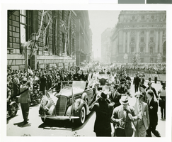
Photograph of a parade for Howard Hughes, New York City, July 15, 1938
Date
1938-07-15
Archival Collection
Description
The black and white view of a crowd consisting of thousands of people who attended a parade that celebrated Howard Hughes completion of his flight Around the World in New York City.
Image
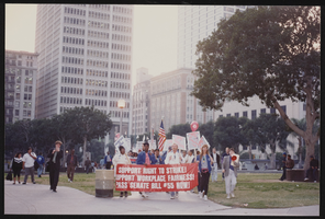
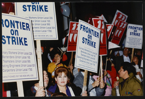
March to Los Angeles: City Hall, Culinary Union, Los Angeles (Calif.), 1992 (folder 1 of 2), image 1
Date
1992
Description
Arrangement note: Series I. Demonstrations, Subseries I.B. Other Demonstrations and Strikes
Image
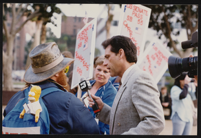
March to Los Angeles: City Hall, Culinary Union, Los Angeles (Calif.), 1992 (folder 1 of 2), image 2
Date
1992
Description
Arrangement note: Series I. Demonstrations, Subseries I.B. Other Demonstrations and Strikes
Image
March to Los Angeles: City Hall, Culinary Union, Los Angeles (Calif.), 1992 (folder 1 of 2), image 3
Date
1992
Description
Arrangement note: Series I. Demonstrations, Subseries I.B. Other Demonstrations and Strikes
Image