Search Results
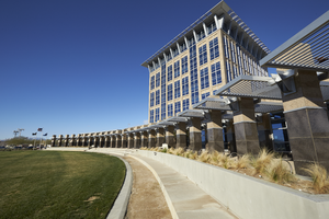
Exterior view of the North Las Vegas City Hall building, looking west in North Las Vegas, Nevada: digital photograph
Date
2019-02-06
Archival Collection
Description
From the UNLV University Libraries Photographs of the Development of the Las Vegas Valley, Nevada (PH-00394). Part of the collection documents the entire 19 mile length of the north/south Eastern Avenue / Civic Center Drive alignment. This photograph was captured in the section of Civic Center Drive between Las Vegas Boulevard and Lake Mead Boulevard.
Image
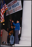
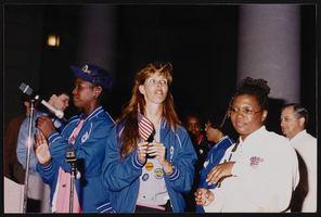
March to Los Angeles: L.A. City Hall, Culinary Union, 1992 (folder 1 of 1), image 10
Date
1992
Description
Arrangement note: Series I. Demonstrations, Subseries I.B. Other Demonstrations and Strikes
Image
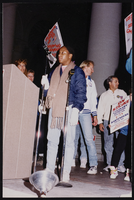
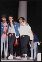
March to Los Angeles: L.A. City Hall, Culinary Union, 1992 (folder 1 of 1), image 11
Date
1992
Description
Arrangement note: Series I. Demonstrations, Subseries I.B. Other Demonstrations and Strikes
Image
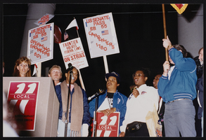
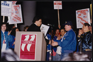
March to Los Angeles: L.A. City Hall, Culinary Union, 1992 (folder 1 of 1), image 12
Date
1992
Description
Arrangement note: Series I. Demonstrations, Subseries I.B. Other Demonstrations and Strikes
Image
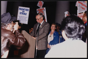
March to Los Angeles: L.A. City Hall, Culinary Union, 1992 (folder 1 of 1), image 13
Date
1992
Description
Arrangement note: Series I. Demonstrations, Subseries I.B. Other Demonstrations and Strikes
Image
March to Los Angeles: L.A. City Hall, Culinary Union, 1992 (folder 1 of 1), image 14
Date
1992
Description
Arrangement note: Series I. Demonstrations, Subseries I.B. Other Demonstrations and Strikes
Image
March to Los Angeles: L.A. City Hall, Culinary Union, 1992 (folder 1 of 1), image 15
Date
1992
Description
Arrangement note: Series I. Demonstrations, Subseries I.B. Other Demonstrations and Strikes
Image

March to Los Angeles: L.A. City Hall, Culinary Union, 1992 (folder 1 of 1), image 16
Date
1992
Description
Arrangement note: Series I. Demonstrations, Subseries I.B. Other Demonstrations and Strikes
Image

March to Los Angeles: L.A. City Hall, Culinary Union, 1992 (folder 1 of 1), image 17
Date
1992
Description
Arrangement note: Series I. Demonstrations, Subseries I.B. Other Demonstrations and Strikes
Image
March to Los Angeles: L.A. City Hall, Culinary Union, 1992 (folder 1 of 1), image 18
Date
1992
Description
Arrangement note: Series I. Demonstrations, Subseries I.B. Other Demonstrations and Strikes
Image