Search Results
Exterior view of the new cafeteria, 1943 July 31
Level of Description
File
Archival Collection
Henderson Public Library Photograph Collection on Henderson, Nevada
To request this item in person:
Collection Number: PH-00254
Collection Name: Henderson Public Library Photograph Collection on Henderson, Nevada
Box/Folder: Folder 05
Collection Name: Henderson Public Library Photograph Collection on Henderson, Nevada
Box/Folder: Folder 05
Archival Component
Rainbow Plaza Resort Hotel Development: Niagara Falls, New York, 1979 September 1
Level of Description
Series
Archival Collection
Martin Stern Architectural Records
To request this item in person:
Collection Number: MS-00382
Collection Name: Martin Stern Architectural Records
Box/Folder: N/A
Collection Name: Martin Stern Architectural Records
Box/Folder: N/A
Archival Component
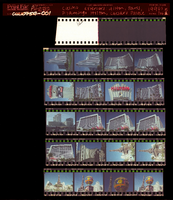
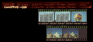
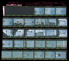
Casino exteriors: Hilton, Paris, Flamingo Hilton, Caesars Palace, Stratosphere, MGM Grand, New York-New York, Frontier Hotel, Culinary Union, Las Vegas (Nev.), 1990s (folder 1 of 1), image 1
Date
1990 to 1999
Description
Arrangement note: Series III. Internal: Work
Image
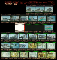
Casino exteriors: Hilton, Paris, Flamingo Hilton, Caesars Palace, Stratosphere, MGM Grand, New York-New York, Frontier Hotel, Culinary Union, Las Vegas (Nev.), 1990s (folder 1 of 1), image 2
Date
1990 to 1999
Description
Arrangement note: Series III. Internal: Work
Image
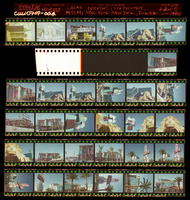
Casino exteriors: Hilton, Paris, Flamingo Hilton, Caesars Palace, Stratosphere, MGM Grand, New York-New York, Frontier Hotel, Culinary Union, Las Vegas (Nev.), 1990s (folder 1 of 1), image 3
Date
1990 to 1999
Description
Arrangement note: Series III. Internal: Work
Image
Casino exteriors: Hilton, Paris, Flamingo Hilton, Caesars Palace, Stratosphere, MGM Grand, New York-New York, Frontier Hotel, Culinary Union, Las Vegas (Nev.), 1990s (folder 1 of 1), image 4
Date
1990 to 1999
Description
Arrangement note: Series III. Internal: Work
Image
Casino exteriors: Hilton, Paris, Flamingo Hilton, Caesars Palace, Stratosphere, MGM Grand, New York-New York, Frontier Hotel, Culinary Union, Las Vegas (Nev.), 1990s (folder 1 of 1), image 5
Date
1990 to 1999
Description
Arrangement note: Series III. Internal: Work
Image
Stoebling, David, New Vegas, 1982 July 08
Level of Description
File
Archival Collection
Frank Mitrani Photographs
To request this item in person:
Collection Number: PH-00332
Collection Name: Frank Mitrani Photographs
Box/Folder: Box 01
Collection Name: Frank Mitrani Photographs
Box/Folder: Box 01
Archival Component
Bodensteiner, Tim, New Vegas, 1982 July 06
Level of Description
File
Archival Collection
Frank Mitrani Photographs
To request this item in person:
Collection Number: PH-00332
Collection Name: Frank Mitrani Photographs
Box/Folder: Box 01
Collection Name: Frank Mitrani Photographs
Box/Folder: Box 01
Archival Component

Map of California, Utah, Nevada, Colorado, New Mexico and Arizona, circa 1867
Date
1865 to 1869
Description
39 x 56 cm. Relief shown by hachures. "Entered according to act of Congress in the year 1864, by A.J. Johnson in the Clerks Office of the United States for the Southern District of New York." Atlas page numbers in upper margin: 67-68. Primer meridians: Greenwich and Washington, D.C. On verso: History and statistical view of the West India islands or Columbian Archipelago and Historical and statistical view of Mexico and Central America. Shows proposed railroads, locations of Indian tribes, natural features, counties, mines, mail routes, trails and routes of exploring expeditions. Has decorative border. Southern part of Nevada was added to the state in 1867 and is part of Nevada on this map, but Lincoln County was established in 1867 and is not on this map. This map was still probably published in 1867 in spite of someone's having written "1864" in pencil in the lower right corner of the Library's copy. Original publisher: A.J. Johnson.
Image