Search the Special Collections and Archives Portal
Search Results
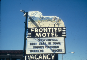
Slide of the Frontier Motel, Carson City, Nevada, 1986
Date
1986
Archival Collection
Description
A color image of the neon sign advertising the Frontier Motel, located in Carson City, Nevada. The sign features a cowboy with a neon lasso.
Image
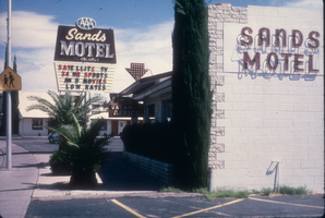
Slide of the Sands Motel, Boulder City, Nevada, 1986
Date
1986
Archival Collection
Description
A color image of the exterior of the Sands Motel, including its neon signs. Site Name: Sands Motel (Boulder City, Nev.)
Image
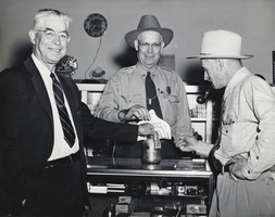
Photograph of Charles F. Peterson and others, Boulder City, Nevada, 1948
Date
1948
Archival Collection
Description
Charles F. Peterson, the Chief Ranger in Boulder City (center), posing beside two other unidentified men in Boulder City, Nevada.
Image
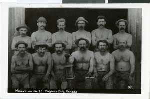
Postcard of miners in Virginia City, Nevada, circa 1920s-1930s
Date
1920 to 1939
Archival Collection
Description
A group photograph of unidentified miners on shift in Virginia City, Nevada. Printed on the front of the card: "Miners on shift - Virginia City, Nevada."
Image
Williams Peak, Arizona, 1923 July 10
Level of Description
File
Archival Collection
Chester R. Longwell Professional Papers
To request this item in person:
Collection Number: MS-00017
Collection Name: Chester R. Longwell Professional Papers
Box/Folder: Box 01
Collection Name: Chester R. Longwell Professional Papers
Box/Folder: Box 01
Archival Component
Johnnie Mine, Nevada, 1923 July 13
Level of Description
File
Archival Collection
Chester R. Longwell Professional Papers
To request this item in person:
Collection Number: MS-00017
Collection Name: Chester R. Longwell Professional Papers
Box/Folder: Box 01
Collection Name: Chester R. Longwell Professional Papers
Box/Folder: Box 01
Archival Component
Prospect Spring, Nevada, 1924 July 21
Level of Description
File
Archival Collection
Chester R. Longwell Professional Papers
To request this item in person:
Collection Number: MS-00017
Collection Name: Chester R. Longwell Professional Papers
Box/Folder: Box 01
Collection Name: Chester R. Longwell Professional Papers
Box/Folder: Box 01
Archival Component
Pagination
Refine my results
Content Type
Creator or Contributor
Subject
Archival Collection
Digital Project
Resource Type
Year
Material Type
Place
Language
Records Classification

