Search Results
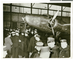
Photograph of the Lockheed 14 in a hangar at Le Bourget Airfield, France, July 1938
Date
1938-07
Archival Collection
Description
Howard Hughes' Lockheed 14 inside a hangar at Le Bourget Airfield.
Image
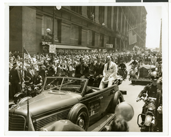
Photograph of Howard Hughes and crew at a parade, New York, July 15, 1938
Date
1938-07-15
Archival Collection
Description
Description printed photograph's accompanying sheet of paper: "Howard Hughes in car receiving the applause of the crowd during his reception in New York. 7-15-38."
Image
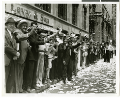
Photograph of a parade procession for Howard Hughes, New York, July 15, 1938
Date
1938-07-15
Archival Collection
Description
A picture of the crowd at a parade celebrating the completion of Howard Hughes' round the world flight.
Image
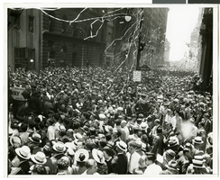
Photograph of a parade procession for Howard Hughes, New York, July 15, 1938
Date
1938-07-15
Archival Collection
Description
A general view of the parade consisting of thousands of people celebrating Howard Hughes' completion of his round-the-world flight.
Image
Photograph of a parade procession for Howard Hughes, New York, July 15, 1938
Date
1938-07-15
Archival Collection
Description
Description printed on photograph's accompanying sheet of paper: "Howard Hughes' wide grin diffuses the lanky Texan's features during a lighter phase of the day's ceremonies. Credit Line (ACME) 7/15/38."
Image
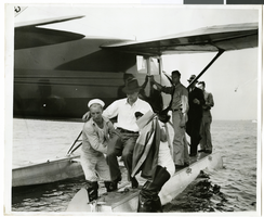
Photograph of Howard Hughes at a U.S. Coast Guard Station, January 15, 1938
Date
1938-01-15
Archival Collection
Description
Description printed on photograph's accompanying strip of paper: Howard Hughes being carried ashore after arrival in amphibian airplane at U.S. Coast Guard Station, Jamaica Bay, B.W.I.
Image
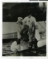
Photograph of Howard Hughes at a U.S. Coast Guard Station, January 15, 1938
Date
1938-01-15
Archival Collection
Description
Description printed on photograph's accompanying strip of paper: Howard Hughes being carried ashore after arrival in amphibian airplane at U.S. Coast Guard Station, Jamaica Bay, B.W.I.
Image
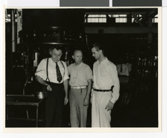
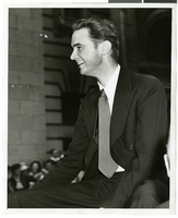
Photograph of Howard Hughes and two men, Houston, Texas, July 30, 1938
Date
1938-07-30
Archival Collection
Description
Howard Hughes (rt.)with two other unidentified men inside the Hughes Tool Co. factory in Houston.
Image
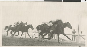
Photograph of horse racing, Las Vegas Downs Racetrack, November 27, 1938
Date
1938-11-27
Archival Collection
Description
Black and white photo of horse racing, Las Vegas Club Handicap at Las Vegas Downs Racetrack. The horse, Jeff's Pride with E. Shea mounted in the left-right, rear. Photo sleeve contains additional materials.
Image
Panoramic perspective maps of Hoover Dam and adjacent areas by the Union Pacific Railroad Company, 1931 to 1938
Level of Description
File
Archival Collection
UNLV University Libraries Collection of Boulder City, Hoover Dam, and Lake Mead National Recreation Area Maps and Brochures
To request this item in person:
Collection Number: MS-00955
Collection Name: UNLV University Libraries Collection of Boulder City, Hoover Dam, and Lake Mead National Recreation Area Maps and Brochures
Box/Folder: Flat File 06
Collection Name: UNLV University Libraries Collection of Boulder City, Hoover Dam, and Lake Mead National Recreation Area Maps and Brochures
Box/Folder: Flat File 06
Archival Component