Search the Special Collections and Archives Portal
Search Results
Dublyansky. Y. "Secondary Mineral Assemblages in Fractures and Lithophysal Cavities at Yucca Mountain, Nevada, USA" Reno, Nevada: Geological Society of America. Accessed 2/26/01. http://www.geosociety.org/cgi-bin/hilight.pl?Dublyansky^/var/www/docs/pubs/abs.../51659.html, 2000 November 14
Level of Description
Archival Collection
Collection Name: Environmental Radiation Protection Standards for Yucca Mountain, Nevada
Box/Folder: Box 37
Archival Component
Water Resource Information Series Report 27: Water-Level Changes Associated with Ground-Water Development in Las Vegas Valley, Nevada, March 1976 to March 1977 by the State of Nevada Department of Conservation and Natural Resources Division of Water Resources and the Geological Survey, United States Department of the Interior, 1977
Level of Description
Archival Collection
Collection Name: Clark County 208 Water Quality Management Plan Records
Box/Folder: Box 01
Archival Component
Rush, F. E., 1970, Regional Ground-Water Systems in the Nevada Test Site Area, Nye, Lincoln, and Clark Counties, Nevada, Water Resources - Reconnaissance Series Report 54, Division of Water Resources, Department of Conservation and Natural Resources in cooperation with the U.S. Geological Survey, U.S. Department of the Interior, Carson City, Nevada, 1970
Level of Description
Archival Collection
Collection Name: Environmental Radiation Protection Standards for Yucca Mountain, Nevada
Box/Folder: Box 15
Archival Component
La Camera, R. J., C. L. Westenburg, and G. L. Locke, 1996, Selected Ground-Water Data for Yucca Mountain Region, Southern Nevada and Eastern California, Through December 1995, OFR-96-553, in cooperation with the Nevada Operations Office of the U.S. Department of Energy, U.S. Geological Survey, U.S. Department of the Interior, Carson City, Nevada, 1996
Level of Description
Archival Collection
Collection Name: Environmental Radiation Protection Standards for Yucca Mountain, Nevada
Box/Folder: Box 13
Archival Component
Environmental Impact Statement for a Proposed Repository at Yucca Mountain, Nevada - Public Scoping Comments Related to the Environmental Impact Statement for a Geologic Repository for the Disposal of Spent Nuclear Fuel and High-Level Radioactive Waste at yucca Mountain, Nye County, Nevada: Environmental Impact Statement for a Proposed Repository at Yucca Mountain, Nevada - Binder, 1997 May
Level of Description
Archival Collection
Collection Name: Yucca Mountain Site Characterization Office Collection
Box/Folder: Box 45
Archival Component

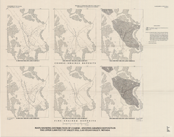
Maps showing distribution of coarse- and fine-grained deposits in the upper 1,000 feet of valley fill, Las Vegas Valley, Nevada, 1981 (Water-supply paper 2320-A, plate 3)
Date
Description
2320-A. Originally published as plate 3 of Ground-water conditions in Las Vegas Valley, Clark County, Nevada. Part I. Hydrogeologic framework / by Russell W. Plume, published by the U.S. Geological Survey in 1989 as Water-supply paper 2320-A.United States Dept. of the Interior, Geological Survey.
Image
DOE (U.S. Department of Energy) 1999. Draft Environmental Impact Statement for a Geologic Repository for the Disposal of Spent Nuclear Fuel and Highlevel Radioactive Waste at Yucca Mountain, Nye County, Nevada. DOE/EIS-0250D. Summary, Volumes I and II. Washington, D.C.: U.S. Department of Energy, Office of Civilian Radioactive Waste Management, 1999
Level of Description
Archival Collection
Collection Name: Environmental Radiation Protection Standards for Yucca Mountain, Nevada
Box/Folder: Box 28
Archival Component
DOE (U.S. Department of Energy), 1997a, Summary of Public Scoping Comments Related to the Environmental Impact Statement for a Geologic Repository for the Disposal of Spent Nuclear Fuel and High-Level Radioactive Waste at Yucca Mountain, Nye County, Nevada, Office of Civilian Radioactive Waste Management, Yucca Mountain Site Characterization Office, North Las Vegas, Nevada, 1997
Level of Description
Archival Collection
Collection Name: Environmental Radiation Protection Standards for Yucca Mountain, Nevada
Box/Folder: Box 10
Archival Component
DOE (U.S. Department of Energy), 1997, Summary of Public Scoping Comments Related to the Environmental Impact Statement for a Geologic Repository for the Disposal of Spent Nuclear Fuel and High-Level Radioactive Waste at Yucca Mountain, Nye County, Nevada, Office of Civilian Radioactive Waste Management, Yucca Mountain Site Characterization Office, North Las Vegas, Nevada, 1997
Level of Description
Archival Collection
Collection Name: Environmental Radiation Protection Standards for Yucca Mountain, Nevada
Box/Folder: Box 21
Archival Component
Josiah Edward Spurr Papers
Identifier
Abstract
Collection consists of an original manuscript, "Geology and Ore-Deposition at Tonopah, Nevada" by Josiah Edward Spurr (1870-1950) with hand-drawn diagrams, and letters discussing the donation of the manuscript. The manuscript, which was published in the journal Economic Geology in 1915, is a geological description of the Tonopah mining area; the Tonopah Mining Company is mentioned frequently. It is undated, but the publication date suggests it was written approximately 1913-1915.
Archival Collection
