Search the Special Collections and Archives Portal
Search Results
Environmental Impact Statement for a Proposed Repository at Yucca Mountain, Nevada: Summary of Public Scoping Comments Related to the Environmental Impact Statement for a Geologic Repository for the Disposal of Spent Nuclear Fuel and High-Level Radioactive Waste at Yucca Mountain, Nye County, Nevada, 1997 May
Level of Description
File
Archival Collection
Yucca Mountain Site Characterization Office Collection
To request this item in person:
Collection Number: MS-00091
Collection Name: Yucca Mountain Site Characterization Office Collection
Box/Folder: Box 96
Collection Name: Yucca Mountain Site Characterization Office Collection
Box/Folder: Box 96
Archival Component
Results of Rock Property Measurements Made on Core Samples from Yucca Mountain Boreholes, Nevada Test Site, Nevada, Part 1: Boreholes UE25A-4, -5, -6, and -7; Part 2: Borehole UE25P#1 - USDOE, USDOI Geological Survey, Open-File Report 90-474, 1991
Level of Description
File
Archival Collection
Yucca Mountain Site Characterization Office Collection
To request this item in person:
Collection Number: MS-00091
Collection Name: Yucca Mountain Site Characterization Office Collection
Box/Folder: Box 85
Collection Name: Yucca Mountain Site Characterization Office Collection
Box/Folder: Box 85
Archival Component
Aerial Photographic Interpretation of Lineaments and Faults in Late Cenozoic Deposits in the Eastern Parts of the Saline Valley 1:100,000 Quadrangle, Nevada and California, and the Darwin Hills 1:100,000 Quadrangle, California - USDOE, USDOI Geological Survey, Open-File Report 90-500, 1991
Level of Description
File
Archival Collection
Yucca Mountain Site Characterization Office Collection
To request this item in person:
Collection Number: MS-00091
Collection Name: Yucca Mountain Site Characterization Office Collection
Box/Folder: Box 85
Collection Name: Yucca Mountain Site Characterization Office Collection
Box/Folder: Box 85
Archival Component
Bonner. L. J., P. E. Elliot, L. P. Etchemendy, and J. R. Swartwood. 1998. Water Resources Data Nevada Water Year 1997, WDR-NV-97-1, in cooperation with the State of Nevada and other agencies. Water Resources Division, U.S. Geological Survey, U.S. Department of the Interior. Carson City, Nevada, 1998
Level of Description
File
Archival Collection
Environmental Radiation Protection Standards for Yucca Mountain, Nevada
To request this item in person:
Collection Number: MS-00603
Collection Name: Environmental Radiation Protection Standards for Yucca Mountain, Nevada
Box/Folder: Box 03
Collection Name: Environmental Radiation Protection Standards for Yucca Mountain, Nevada
Box/Folder: Box 03
Archival Component
Bostic. R. E., R. L. Kane, K. M. Kipfer. and A. W. Johnson. 1997, Water Resources Data Nevada Water Year 1996, WDR-NV-96-1, in cooperation with the State of Nevada and other agencies. Water Resources Division. U.S. Geological Survey, U.S. Department of the Interior. Carson City, Nevada, 1997
Level of Description
File
Archival Collection
Environmental Radiation Protection Standards for Yucca Mountain, Nevada
To request this item in person:
Collection Number: MS-00603
Collection Name: Environmental Radiation Protection Standards for Yucca Mountain, Nevada
Box/Folder: Box 04
Collection Name: Environmental Radiation Protection Standards for Yucca Mountain, Nevada
Box/Folder: Box 04
Archival Component

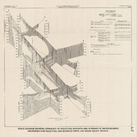
Fence diagram showing lithology of valley-fill deposits and summary of water-bearing properties for valley-fill and bedrock units, Las Vegas Valley, Nevada, 1981 (Water-supply paper 2320-A)
Date
1981
Description
'Department of the Interior, U.S. Geological Survey. Water-supply paper 2320-A, plate 2.' 'Prepared in cooperation with the Clark County Department of Comprehensive Planning.' 'Geology by R.W. Plume, 1981.' Scale [ca. 1:95,040. 1 in.=approx. 1.5 miles]. Series: U.S. Geological Survey water-supply paper
2320-A. Originally published as plate 2 of Ground-water conditions in Las Vegas Valley, Clark County, Nevada. Part I. Hydrogeologic framework / by Russell W. Plume, published by the U.S. Geological Survey in 1989 as Water-supply paper 2320-A. "Prepared in cooperation with the Clark County Department of Comprehensive Planning."
2320-A. Originally published as plate 2 of Ground-water conditions in Las Vegas Valley, Clark County, Nevada. Part I. Hydrogeologic framework / by Russell W. Plume, published by the U.S. Geological Survey in 1989 as Water-supply paper 2320-A. "Prepared in cooperation with the Clark County Department of Comprehensive Planning."
Text
ASTM C 1174-97. 1998. Standard Practice for Prediction of the Long-Term Behavior of Materials, Including Waste Forms, Used in Engineered Barrier Systems (EBS) for Geological Disposal of High-Level Radioactive Waste. West Conshohocken, Pennsylvania: American Society for Testing and Materials, 1998
Level of Description
File
Archival Collection
Environmental Radiation Protection Standards for Yucca Mountain, Nevada
To request this item in person:
Collection Number: MS-00603
Collection Name: Environmental Radiation Protection Standards for Yucca Mountain, Nevada
Box/Folder: Box 29
Collection Name: Environmental Radiation Protection Standards for Yucca Mountain, Nevada
Box/Folder: Box 29
Archival Component

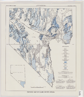
Tectonic map of Clark County, Nevada, 1965
Date
1965
Description
'Nevada Bureau of Mines. Bulletin 62, plate 5.' 'Prepared cooperatively by the U.S. Geological Survey.' Shows types of rocks as well as faults. Scale [ca. 1:760,320. 1 in. to approx. 12 miles] (W 116°--W 114°/N 37°--N 35°). Bulletin (Nevada Bureau of Mines)
62.
62.
Image

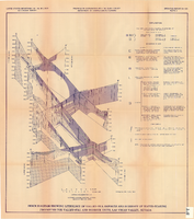
Fence diagram showing lithology of valley-fill deposits and summary of water-bearing properties for valley-fill and bedrock units, Las Vegas Valley, Nevada, 1981 (Open-file report 84-130)
Date
1981
Description
'United States Department of the Interior, Geological Survey. Open-file report 84-130, plate 2.' 'Prepared in cooperation with the Clark County Department of Comprehensive Planning.' 'Geology by R.W. Plume, 1981.' Scale [ca. 1:31,680. 1 in.=approx. .5 miles]. . Series: Open-file report (Geological Survey (U.S.))
84-130. Originally published as plate 2 of Ground-water conditions in Las Vegas .Valley, Clark County, Nevada. Part I. Hydrogeologic framework / by Russell W. Plume, published by the U.S. Geological Survey in 1984 as Open-file report 84-130. "Prepared in cooperation with the Clark County Department of Comprehensive Planning."
84-130. Originally published as plate 2 of Ground-water conditions in Las Vegas .Valley, Clark County, Nevada. Part I. Hydrogeologic framework / by Russell W. Plume, published by the U.S. Geological Survey in 1984 as Open-file report 84-130. "Prepared in cooperation with the Clark County Department of Comprehensive Planning."
Text
Wilson, N. S.F.; Cline. J.S.; Robert. J.; and Amelin, Y.V. 2000. " Timing and Temperature of Fluid Movement at Yucca Mountain, NV: Fluid Inclusion Analyses and U-Pb and U-Series Dating." Abstracts with Programs - Geoiogical Society of America 32, (7), A-260. Boulder, Colorado: Geological Society of America, 2000
Level of Description
File
Archival Collection
Environmental Radiation Protection Standards for Yucca Mountain, Nevada
To request this item in person:
Collection Number: MS-00603
Collection Name: Environmental Radiation Protection Standards for Yucca Mountain, Nevada
Box/Folder: Box 45
Collection Name: Environmental Radiation Protection Standards for Yucca Mountain, Nevada
Box/Folder: Box 45
Archival Component
Pagination
Refine my results
Content Type
Creator or Contributor
Subject
Archival Collection
Digital Project
Resource Type
Year
Material Type
Place
Language
Records Classification
