Search the Special Collections and Archives Portal

Search Results
Display    Results Per Page
Displaying results 951 - 960 of 2340

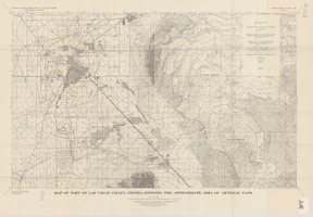
Map of part of Las Vegas Valley, Nevada, showing the approximate area of artesian flow, 1965

Date

1965

Description

At top of map: 'United States Department of the Interior, Geological Survey. Water supply paper 1780, plate 2.' At bottom of map: 'Base from U.S. Geological Survey Las Vegas (1952) and Henderson (1952) quadrangles.' 'Interior--Geological Survey, Washigton, D.C.--1965--W63358.' Relief shown by contours. Includes township and range lines. Thematic map. Scale 1:62,500 (W 115°15´--W 114°45´/N 36°15´--N 36°00´). Series: Water-supply paper (Washington, D.C.)
1780. Originally published as plate 2 of Available water supply of the Las Vegas ground-water basin, Nevada, by Glenn T. Malmberg, published by the Geological Survey in 1965 as its Water-supply paper 1780.

Image

David L. Weide oral history interview

Identifier

OH-01936

Abstract

Oral history interview with David L. Weide conducted by Claytee D. White on May 31, 2007 for the Boyer Early Las Vegas Oral History Project. In this interview, Weide discusses his career as a geologist, teaching geology at the University of Nevada, Las Vegas, and the history of the University of Las Vegas, Nevada. Weide begins by explaining the history behind the name "Blue Diamond Village," how he came to study geology at the University of California, Los Angeles, and the employment process at UNLV. He describes the geological history of Nevada, hosting his own folk music program on the local radio station, KNPR, and his opinions on UNLV's intention to become a "Research One" institution.

Archival Collection
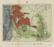
Map of part of north central New Mexico, atlas sheet no. 70(C), May 7th, 1877

Date

1877-05-07

Description

39 x 50 cm. Relief shown by hachures and spot heights. "Issued May 7th 1877-2nd ed. June 30th, 1881." "Expeditions of 1878 and 1879 under the command of 1st. Lieut. Geo. M. Wheeler, Corp. of Engineers U.S. Army." "Weyss Herman & Lang Del." Prime meridians: Washington, D.C. and Greenwich Geological map Probably originally published as part of the geological atlas which is an appendix to the Surveys' Report upon United States geographical surveys west of the one hundredth meridian. "Prof. John J. Stevenson, geological assistant." "By order of the honorable the Secretary of War under the direction of Brig. General A. A. Hunphreys, Chief of Engineers, U. S. Army." Original publisher: U.S. Geographical Surveys West of the 100th Meridian, Scale: 1 inch to 4 miles or 1: 253440.

Image

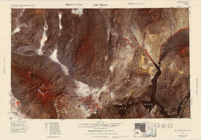
Satellite image map of the Las Vegas Valley, 1981

Date

1981

Description

'1981. Experimental edition 36114-A1-SI-250.' Scale 1:250,000 ; Transverse Mercator proj. (W 116°--W 114°/N 37°--N 36°). Series: Western United States 1:250,000. Western United States 1:250,000 ; NJ 11-12. Filing title: Las Vegas, Nev.; Ariz.; Calif. 'Imagery recorded with Multispectral Scanner (MSS) on NASA Landsat-3.' Includes image coverage diagram. Separate map on verso: Las Vegas / prepared by the U.S. Army Topographic Command ; revised by the U.S. Geological Survey 1969. Ed. 5. Washington, D.C. : Geological Survey, 1976, NJ 11-12 in the series Western United States 1:250,000. United States Geological Survey

Image

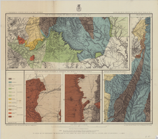
Map of part of North Central New Mexico atlas sheets 69(B), 69(D), 77(B) and 78(A), June 30, 1881

Date

1881-06-30

Description

39 x 52 cm. Relief shown by hachures and spot heights "Issued June 30, 1881." "Expeditions of 1873, 1878 and 1879 under the command of 1st. Lieut. Geo. M. Wheeler, Corps of Engineers U.S. Army." Geological map Probably originally published as part of the geological atlas which is an appendix to the Surveys' Report upon United States geographical surveys west of the one hundredth meridian. "Prof. John J. Stevenson, geological assistant." "By order of the honorable the Secretary of War under the direction of Brig. General A. A. Hunphreys, Chief of Engineers, U. S. Army." Original publisher: U.S. Geographical Surveys West of the 100th Meridian, Scale: 1 inch to 4 miles or 1: 253440.

Image

Chester Longwell Photograph Collection

Identifier

PH-00311

Abstract

The Chester Longwell Photograph Collection consists of 608 black-and-white photographic prints dating from approximately 1910 to 1930. The images primarily depict the Longwell family's excursions in the Southern Nevada region, primarily to Mount Charleston, Nevada. Also included are images of Southern Nevada mines and mining towns, as well as Pubelo Grande de Nevada, the Lost City. The remaining images depict geological formations and features, as well as forestry and nature scenes in Nevada and Arizona.

Archival Collection
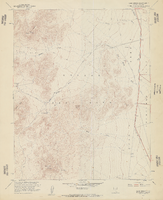
Topographic map of Cane Spring, Nevada quadrangle, 1961

Date

1961

Description

'Mapped, edited and published by the Geological Survey in cooperation with the Atomic Enegry Commission. Control by USGS, USC&GS, USCE, and Atomic Energy Commission. Topography from aerial photographs by photogrammetric methods. Aerial photographs taken 1959. Field check 1961.' Scale 1:24,000 polyconic projection (W 116°07'30"--W 116°00'00"/N 36°52'30"--N 36°45'00"). Series: 7.5 minute series (topographic). Relief shown by contours and spot heights. Contour interval 20 feet. Includes quadrangle location map. Interior--Geological Survey
For sale by the U.S. Geological Survey

Image
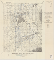
Map of part of Las Vegas Valley, Nevada, showing the approximate piezometric surface in 1912

Date

1965

Description

'Base by U.S. Geological Survey, 1952.' 'Interior--Geological Survey, Washington, D.C.--1965--W63358.' 'Compiled from data published by Carpenter (1915), Kearney (1913), and McWilliams (1913).' Relief shown by contours. Includes township and range lines. Scale 1:62,500 (W 115°15´--W 115°00´/N 36°15´--N 36°00´). Series: Water-supply paper (Washington, D.C.)
1780. Originally published as plate 7 of Available water supply of the Las Vegas ground-water basin, Nevada, by Glenn T. Malmberg, published by the Geological Survey in 1965 as its Water-supply paper 1780.

Image
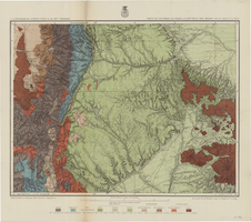
Map of parts of southern Colorado and northern New Mexico, atlas sheet no. 70(A), 1877

Date

1877-05-07

Description

37 x 50 cm. Prime meridian: Washington, D.C. Relief shown by hachures and spot heights. "Issued May 7th, 1877. 2nd ed., June 30th, 1881." "Atlas sheet no. 77(B)." "Expeditions of 1871 & 1786 under the command of 1st. Lieut. Geo. M. Wheeler, Corps of Engineers, U.S. Army." "Weyss, Herman & Lang, del." Probably originally published as part of the geological atlas which is an appendix to the Surveys' Report upon United States geographical surveys west of the one hundredth meridian. Geological map. "Prof. John J. Stevenson, geological assistant." Original publisher: U.S. Geographical Surveys West of the 100th Meridian, Scale: 1 inch to 4 miles or 1: 253440.

Image