Search the Special Collections and Archives Portal
Search Results
Series VII. Rock specimen tags, approximately 1921 to 1969
Level of Description
Scope and Contents
The rock specimen tags series (1921-1969) consists of United States Geological Survey and personally made tags containing information on the provenance of rock specimens collected by Chester Longwell. The specimens associated with these tags are not part of the collection.
Archival Collection
Collection Name: Chester R. Longwell Professional Papers
Box/Folder: N/A
Archival Component
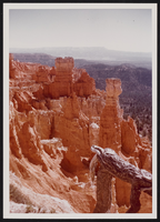
Bryce Canyon National Park and Rainbow Bridge, Utah: photographic prints
Date
Archival Collection
Description
Image
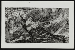
Photograph and description of a mountain folding: photographic prints
Date
Archival Collection
Description
Mixed Content

View of a mountain folding and lengthy description: photographic prints
Date
Archival Collection
Description
Mixed Content
Series IV. Subject files, 1917 to 1972
Level of Description
Scope and Contents
The subject files series (1917-1972) series consists of papers from professional geological associations and societies, financial matters, business concerns, and personal and professional matters. Also included are educational materials related to courses Longwell taught at Yale University.
Archival Collection
Collection Name: Chester R. Longwell Professional Papers
Box/Folder: N/A
Archival Component
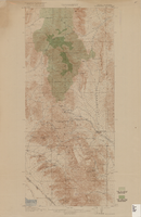
Topographic map of Goodsprings quadrangle, Nevada and California, 1919
Date
Description
Text

