Search the Special Collections and Archives Portal

Search Results

Display    Results Per Page
Displaying results 1021 - 1030 of 2340

Yucca Mountain Site Characterization Office Collection

Identifier

MS-00091

Abstract

The Yucca Mountain Site Characterization Office collection (1958-2001) was assembled through a joint effort between the Nuclear Regulatory Commission (NRC) and the James R. Dickinson Library, University of Nevada, Las Vegas (UNLV) to provide public access to documentation and correspondence about the proposed high-level radioactive waste geologic repository site near Yucca Mountain, Nevada. Materials include technical reports, contractor reports, public hearing transcripts, safety evaluation reports, environmental impact statements, emergency plans, inspection reports, licensee event reports, and general communications. The collection includes documents from several other government entities such as the Yucca Mountain Site Characterization Office, Department of Energy, Office of Civilian Radioactive Waste Management (OCRWM), Nevada Nuclear Waste Storage Investigations (NNWSI), United States Geological Survey (USGS), Sandia National Laboratories, Lawrence Livermore National Laboratory, and Los Alamos National Laboratory.

Archival Collection
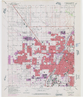
Topographic map of the northeast quadrangle of the metropolitan Las Vegas, Nevada area, 1973

Date

1973

Description

Scale 1:24,000 ; polyconic proj. (W 115°730--W 115°0000/N 36°1500--N 36°730) ; 1 map : col. ; 58 x 47 cm ; 7.5 minute series (topographic) ; Relief shown by contours and spot heights ; "AMS 2956 II NE--Series V896." ; Contour interval 20 feet ; "Topography by photogrammetric methods from aerial photographs taken 1965. Field checked 1967." ; "Revisions shown in purple compiled from aerial photographs taken 1973. This information not field checked." ; Includes quadrangle location map ; Filing title: Las Vegas, NE, Nev ; Interior--Geological Survey

Image

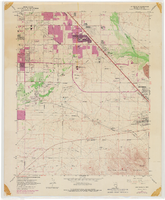
Topographic map of the northwest quadrangle of the metropolitan Las Vegas, Nevada area, 1973

Date

1973

Description

Scale 1:24,000 ; polyconic proj. (W 115°1500--W 115°730/N 36°1500--N 36°730) ; 1 map : col. ; 58 x 47 cm ; 7.5 minute series (topographic) ; Relief shown by contours and spot heights ; Filing title: Las Vegas NM, Nev ; "AMS 2956 II NW--Series V896." ; Contour interval 10 feet ; "Topography by photogrammetric methods from aerial photographs taken 1965. Field checked 1967." ; "Revisions shown in purple compiled from aerial photographs taken 1973. This information not field checked." ; Includes quadrangle location map ; Interior--Geological Survey

Image

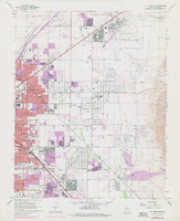
Topographic map of the southeast quadrangle of the metropolitan Las Vegas, Nevada area, 1973

Date

1973

Description

Scale 1:24,000 ; polyconic proj. (W 115°0730--W 115°0000/N 36°0730--N 36°0000) ; 1 map : col. ; 58 x 47 cm ; 7.5 minute series (topographic) ; Relief shown by contours and spot heights ; Filing title: Las Vegas SE, Nev ; "AMS 2956 II SE--Series V896." ; Contour interval 20 feet ; "Topography by photogrammetric methods from aerial photographs taken 1965. Field checked 1967." ; "Revisions shown in purple compiled from aerial photographs taken 1973. This information not field checked." ; Includes quadrangle location map ; Interior--Geological Survey

Image

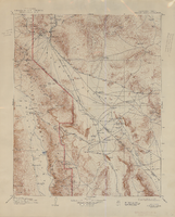
Topographic map of the Furnace Creek quadrangle, Nevada and California, 1947

Date

1947

Description

'E.M. Douglas, geographer. R.H. Chapman, in charge of section. Topography by R.H. Chapman, B.D. Stewart, J.E. Blackburn and D.F.C. Moor. Traingulation by R.H. Chapman and D.F.C. Moor. Surveyed in1905-1906.' 'Edition of Apr. 1910, reprinted 1947.' Scale 1:250,000 ; polyconic proj. (W 117°00´--W 116°00´/N 37°00´--N 36°00´). Relief shown by contours and spot heights. 'North American datum.' 'Contour interval 100 feet.' 'Datum is mean sea level.' Text and illustrations from the Topographic maps of the United States series on verso. Series: The topograhic maps of the United States. United States, Dept. of the Interior, Geological Survey

Text

Geological Society of America

No description.

Corporate Body

Geological Survey (U.S.)

No description.

Corporate Body

Transcript of interview with Ernest Clary by Tom Mattingly, February 10, 1979

Date

1979-02-10

Description

On February 10, 1979, collector Tom Mattingly interviewed his neighbor, professional engineer geologist and registered surveyor, Ernest Henry Clary (born May 21st, 1906 in Lincoln, Nebraska) in the collector’s home in Las Vegas, Nevada. The interview covers Mr. Clary’s personal and professional life and the history of Nevada, including, the early above-ground atomic tests, presidential visits and the crash of Carole Lombard’s plane. All persons present during the interview, include: Tom Mattingly, Ernest Clary, Mary Mattingly, and Matt Mattingly.

Text
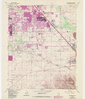
Topographic map of the southeast quadrangle of the metropolitan Las Vegas, Nevada area, 1984

Date

1984

Description

Scale 1:24,000 ; polyconic proj. (W 115°0730--W 115°0000/N 36°0730--N 36°0000) ; 1 map : col. ; 58 x 47 cm ; 7.5 minute series (topographic) ; Relief shown by contours and spot heights ; Filing title: Las Vegas SE, Nev ; "DMA 2956 II SE--Series V896." ; Contour interval 20 feet ; "Topography by photogrammetric methods from aerial photographs taken 1965. Field checked 1967." ; "Revisions shown in purple and woodland compiled from aerial photographs taken 1982 and other sources. This information not field checked. Map edited 1984." ; Includes quadrangle location map ; Interior--Geological Survey

Image