Search the Special Collections and Archives Portal
Search Results
Hillsway's Who's Who: Favorite Recipes of Famous People and Personalities, 1978
Level of Description
Archival Collection
Collection Name: Vassili Sulich Papers
Box/Folder: Box 03
Archival Component

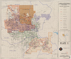
Map showing plan for water quality management update for wastewater collection systems in the Las Vegas Valley, February 20, 1997
Date
Description
Image
Keno, "3rd Place - Favorite casino for Keno" award from the Las Vegas Guide, 2004
Level of Description
Archival Collection
Collection Name: Stardust Resort and Casino Records
Box/Folder: Box 093
Archival Component
#65372: Griffin, Lori (Geoscience Undergraduate) - "Favorite Places to Hang Out" Article, 2006 October 12
Level of Description
Archival Collection
Collection Name: University of Nevada, Las Vegas Creative Services Records (2000s)
Box/Folder: N/A
Archival Component
Glasgow Peggy; to which is added the favourite ballad of the Drowned Lovers. Glasgow, approximately 1850 to 1859
Level of Description
Archival Collection
Collection Name: Mavis Eggle "Books as They Were Bought" Collection
Box/Folder: Box 27
Archival Component
The favorite horse at Kiel Ranch, with Sunrise Mountain visibile in the background: glass plate negative, approximately 1893 to 1904
Level of Description
Archival Collection
Collection Name: Kiel Family Photographs
Box/Folder: Box 01 (Restrictions apply)
Archival Component
UNLV Special Collections Photograph Collection of Book Illustrations
Identifier
Abstract
The UNLV Special Collections Photograph Collection of Book Illustrations (approximately 1900-2000) consists of photographic reproductions of book illustrations. The images relate to the history of Nevada, with a lesser focus on the broader American West.
Archival Collection
Hurley, William and Lawrence McDonough, "The Favourite-Longshot Bias in Parimutuel Betting: A Clarification of the Explanation that Bettors Like to Bet Longshots", 1997
Level of Description
Archival Collection
Collection Name: Eugene Martin Christiansen Papers
Box/Folder: Box 080
Archival Component
S. R. Shapiro Collection
Identifier
Abstract
The S. R. Shapiro Collection (1799, 1960-1979) contains gaming instructions, pamphlets, menus, promotional material from travel agents and casinos, and correspondence from Las Vegas, Nevada casinos and casinos around the world. There is also a copy of a French natural history book titled Memories de la Societe d'histoire naturelle de Paris dated 1799. Inside the book are attached advertisements and lottery announcements from English newspapers.
Archival Collection
Collection processing guidelines, collection guides, collection inventories, collection status worksheets, training session information, 1994-1998
Level of Description
Archival Collection
Collection Name: Nevada Women's Archives Records
Box/Folder: Box 03
Archival Component
