Search the Special Collections and Archives Portal
Search Results
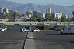
Commercial Center on East Sahara Avenue west of Maryland Parkway, Las Vegas, Nevada: digital photograph
Date
2017-09-12
Archival Collection
Description
Businesses ring the Clark County owned parking area of Commercial Center on East Sahara Avenue just west of Maryland Parkway. Commercial Center is a unique business area along Sahara Avenue. Once a major mall with a single owner, now it is owned by separate property owners, while its expansive parking area is owned and maintained by Clark County.
Image
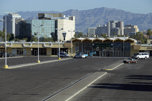
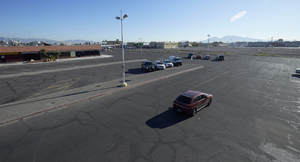
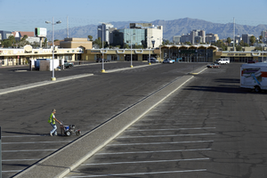
Commercial Center on East Sahara Avenue west of Maryland Parkway, Las Vegas, Nevada: digital photograph
Date
2017-09-12
Archival Collection
Description
A man stripes the parking lot at Commercial Center on East Sahara Avenue just west of Maryland Parkway. Commercial Center is a unique business area along Sahara Avenue. Once a major mall with a single owner, now it is owned by separate property owners, while its expansive parking area is owned and maintained by Clark County.
Image
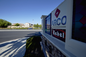
Rebel Arco sign looking west towards single family housing in Summerlin, Las Vegas, Nevada: digital photograph
Date
2017-08-25
Archival Collection
Description
As the Summerlin masterplanned development ends at South Hualapai Way and West Sahara Avenue, development changes from lushly landscaped sidewalks and multifamily housing transitions to a more traditional Las Vegas development pattern including a Rebel ARCO gas station placed across the street from large single family housing on the Summerlin side.
Image
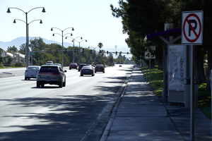
West Sahara Avenue looking east from South Hualapai Way, Las Vegas, Nevada: digital photograph
Date
2017-08-25
Archival Collection
Description
Looking east down West Sahara Avenue from South Hualapai Way. This view illustrates the difference between the lushly landscaped meandering sidewalks and medians of Summerlin and the less controlled areas of West Sahara Avenue's development. Straight roadside sidewalks, no median landscaping and a bus lane that begins at South Hualapai Way signal a transition from the popular masterplanned community.
Image
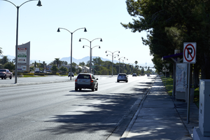
West Sahara Avenue looking east from South Hualapai Way, Las Vegas, Nevada: digital photograph
Date
2017-08-25
Archival Collection
Description
Looking east down West Sahara Avenue from South Hualapai Way. This view illustrates the difference between the lushly landscaped meandering sidewalks and medians of Summerlin and the less controlled areas of West Sahara Avenue's development. Straight roadside sidewalks, no median landscaping and a bus lane that begins at South Hualapai Way signal a transition from the popular masterplanned community.
Image
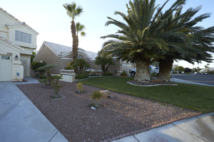
Single family residences with desert landscaping and grass near West Sahara Avenue, Las Vegas, Nevada: digital photograph
Date
2017-08-27
Archival Collection
Description
Typical single family residences at 2217 South Diamondback Drive and 2215 Marble Gorge Drive near West Sahara Avenue. This photograph illustrates the movement from front yards featuring grass to those utilizing desert landscaping. Most residential development has moved from the grass front yards commonplace with development through the late 1990s to desert landscaping.
Image
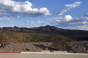
A mailbox in the Ascaya development prior residents building homes, Henderson, Nevada: digital photograph
Date
2017-08-05
Archival Collection
Description
Infrastructure for the Ascaya luxury home development, including mailboxes like this one along Cloudrock Court, power, gas, and roads was completed before sales of lots began. This has created the unusual site of having an entire master planned community built but no homes or residents. Ascaya, carved into the McCullough Mountain range in Henderson, Nevada, was completed with materials mined from the site.
Image
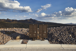
A mailbox in the Ascaya development prior residents building homes, Henderson, Nevada: digital photograph
Date
2017-08-05
Archival Collection
Description
Infrastructure for the Ascaya luxury home development, including mailboxes like this one along Cloudrock Court, power, gas, and roads was completed before sales of lots began. This has created the unusual site of having an entire master planned community built but no homes or residents. Ascaya, carved into the McCullough Mountain range in Henderson, Nevada, was completed with materials mined from the site.
Image
Pagination
Refine my results
Content Type
Creator or Contributor
Subject
Archival Collection
Digital Project
Resource Type
Year
Material Type
Place
Language
Records Classification
