Search Results
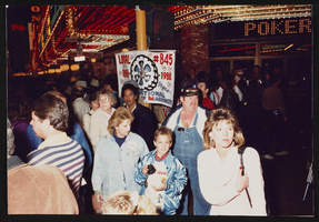
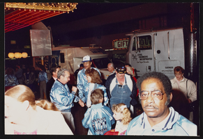
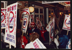
Jesse Jackson rally, Culinary Union, Las Vegas (Nev.), 1989 December (folder 4 of 6), image 60
Date
1989-12
Description
Arrangement note: Series I. Demonstrations, Subseries I.B. Other Demonstrations and Strikes
Image
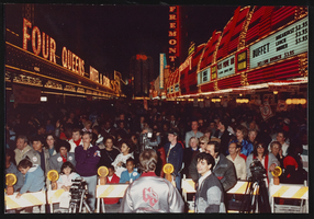
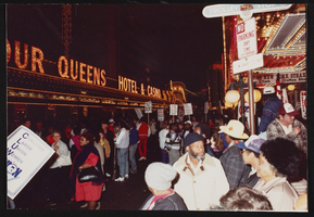
Jesse Jackson rally, Culinary Union, Las Vegas (Nev.), 1989 December (folder 4 of 6), image 61
Date
1989-12
Description
Arrangement note: Series I. Demonstrations, Subseries I.B. Other Demonstrations and Strikes
Image
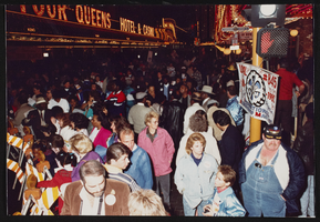
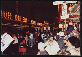
Jesse Jackson rally, Culinary Union, Las Vegas (Nev.), 1989 December (folder 4 of 6), image 62
Date
1989-12
Description
Arrangement note: Series I. Demonstrations, Subseries I.B. Other Demonstrations and Strikes
Image
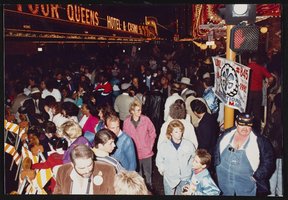
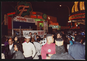
Jesse Jackson rally, Culinary Union, Las Vegas (Nev.), 1989 December (folder 4 of 6), image 63
Date
1989-12
Description
Arrangement note: Series I. Demonstrations, Subseries I.B. Other Demonstrations and Strikes
Image
Jesse Jackson rally, Culinary Union, Las Vegas (Nev.), 1989 December (folder 4 of 6), image 64
Date
1989-12
Description
Arrangement note: Series I. Demonstrations, Subseries I.B. Other Demonstrations and Strikes
Image
Jesse Jackson rally, Culinary Union, Las Vegas (Nev.), 1989 December (folder 4 of 6), image 65
Date
1989-12
Description
Arrangement note: Series I. Demonstrations, Subseries I.B. Other Demonstrations and Strikes
Image
Jesse Jackson rally, Culinary Union, Las Vegas (Nev.), 1989 December (folder 4 of 6), image 66
Date
1989-12
Description
Arrangement note: Series I. Demonstrations, Subseries I.B. Other Demonstrations and Strikes
Image
Jesse Jackson rally, Culinary Union, Las Vegas (Nev.), 1989 December (folder 4 of 6), image 67
Date
1989-12
Description
Arrangement note: Series I. Demonstrations, Subseries I.B. Other Demonstrations and Strikes
Image
Jesse Jackson rally, Culinary Union, Las Vegas (Nev.), 1989 December (folder 4 of 6), image 68
Date
1989-12
Description
Arrangement note: Series I. Demonstrations, Subseries I.B. Other Demonstrations and Strikes
Image

Jesse Jackson rally, Culinary Union, Las Vegas (Nev.), 1989 December (folder 4 of 6), image 69
Date
1989-12
Description
Arrangement note: Series I. Demonstrations, Subseries I.B. Other Demonstrations and Strikes
Image