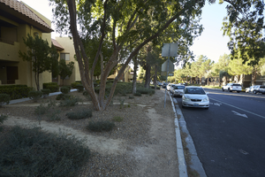
Search Results
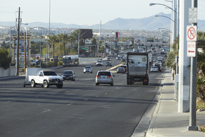
Traffic flows on Eastern Avenue north of Pebble Road, looking south in Las Vegas, Nevada: digital photograph
Date
Archival Collection
Description
From the UNLV University Libraries Photographs of the Development of the Las Vegas Valley, Nevada (PH-00394). Part of the collection documents the entire 19 mile length of the north/south Eastern Avenue / Civic Center Drive alignment. This photograph was captured in the section of Eastern Avenue between Windmill Parkway and Pebble Road.
Image
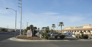
Exterior of Star Nursery on Eastern Avenue north of Pebble Road, looking south-southwest in Las Vegas, Nevada: digital photograph
Date
Archival Collection
Description
From the UNLV University Libraries Photographs of the Development of the Las Vegas Valley, Nevada (PH-00394). Part of the collection documents the entire 19 mile length of the north/south Eastern Avenue / Civic Center Drive alignment. This photograph was captured in the section of Eastern Avenue between Windmill Parkway and Pebble Road.
Image
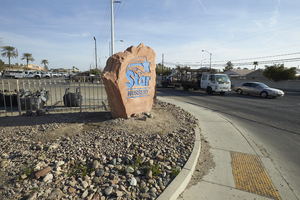
Star Nursery sign and traffic on Eastern Avenue north of Pebble Road, looking north-northeast in Las Vegas, Nevada: digital photograph
Date
Archival Collection
Description
From the UNLV University Libraries Photographs of the Development of the Las Vegas Valley, Nevada (PH-00394). Part of the collection documents the entire 19 mile length of the north/south Eastern Avenue / Civic Center Drive alignment. This photograph was captured in the section of Eastern Avenue between Windmill Parkway and Pebble Road.
Image
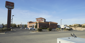
Exterior of a Kopper Keg location on Eastern Avenue north of Pebble Road, looking south-southwest in Las Vegas, Nevada: digital photograph
Date
Archival Collection
Description
From the UNLV University Libraries Photographs of the Development of the Las Vegas Valley, Nevada (PH-00394). Part of the collection documents the entire 19 mile length of the north/south Eastern Avenue / Civic Center Drive alignment. This photograph was captured in the section of Eastern Avenue between Windmill Parkway and Pebble Road.
Image
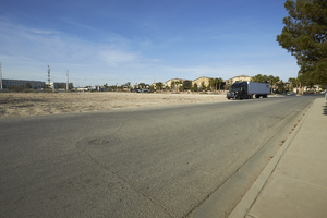
Vacant land on Torino Avenue near Eastern Avenue north of Pebble Road, looking southwest in Las Vegas, Nevada: digital photograph
Date
Archival Collection
Description
From the UNLV University Libraries Photographs of the Development of the Las Vegas Valley, Nevada (PH-00394). Part of the collection documents the entire 19 mile length of the north/south Eastern Avenue / Civic Center Drive alignment. This photograph was captured in the section of Eastern Avenue between Windmill Parkway and Pebble Road.
Image
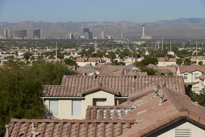
Single family home rooftops with a Las Vegas Strip view as seen from Hollywood Boulevard south of East Sahara Avenue, looking west, Las Vegas, Nevada: digital photograph
Date
Archival Collection
Description
Image
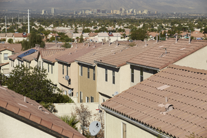
Single family home rooftops with a downtown view as seen from Hollywood Boulevard south of East Sahara Avenue, looking west, Las Vegas, Nevada: digital photograph
Date
Archival Collection
Description
Image
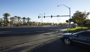
Traffic lights on West Sahara Avenue west of Fort Apache Road, looking northeast, Las Vegas, Nevada: digital photograph
Date
Archival Collection
Description
Image
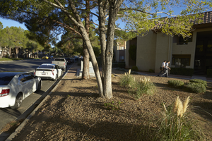
Landscaping along Grand Canyon Drive south of West Sahara Avenue, looking south, Las Vegas, Nevada: digital photograph
Date
Archival Collection
Description
Image
Landscaping along Grand Canyon Drive south of West Sahara Avenue, looking north. Las Vegas, Nevada: digital photograph
Date
Archival Collection
Description
Image