Search Results
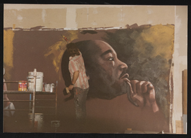
Martin Luther King day, Culinary Union, Las Vegas (Nev.), 1993 January 16 (folder 1 of 1), image 3 (back)
Date
1993-01-16
Description
Arrangement note: Series I. Demonstrations, Subseries I.B. Other Demonstrations and Strikes
Text

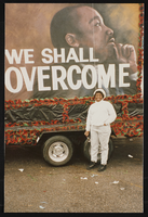
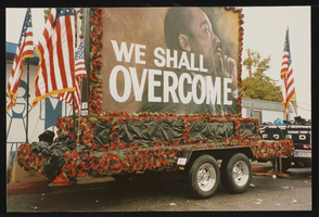
Martin Luther King day, Culinary Union, Las Vegas (Nev.), 1993 January 16 (folder 1 of 1), image 4 (front)
Date
1993-01-16
Description
Arrangement note: Series I. Demonstrations, Subseries I.B. Other Demonstrations and Strikes
Martin Luther King day, Culinary Union, Las Vegas (Nev.), 1993 January 16 (folder 1 of 1), image 4 (back)
Date
1993-01-16
Description
Arrangement note: Series I. Demonstrations, Subseries I.B. Other Demonstrations and Strikes
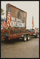
Martin Luther King day, Culinary Union, Las Vegas (Nev.), 1993 January 16 (folder 1 of 1), image 5
Date
1993-01-16
Description
Arrangement note: Series I. Demonstrations, Subseries I.B. Other Demonstrations and Strikes
Image
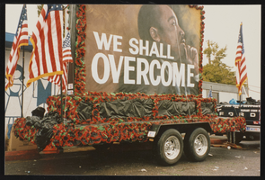
Martin Luther King day, Culinary Union, Las Vegas (Nev.), 1993 January 16 (folder 1 of 1), image 6
Date
1993-01-16
Description
Arrangement note: Series I. Demonstrations, Subseries I.B. Other Demonstrations and Strikes
Image
Martin Luther King day, Culinary Union, Las Vegas (Nev.), 1993 January 16 (folder 1 of 1), image 7
Date
1993-01-16
Description
Arrangement note: Series I. Demonstrations, Subseries I.B. Other Demonstrations and Strikes
Image
Martin Luther King day, Culinary Union, Las Vegas (Nev.), 1993 January 16 (folder 1 of 1), image 8
Date
1993-01-16
Description
Arrangement note: Series I. Demonstrations, Subseries I.B. Other Demonstrations and Strikes
Image
Martin Luther King day, Culinary Union, Las Vegas (Nev.), 1993 January 16 (folder 1 of 1), image 9
Date
1993-01-16
Description
Arrangement note: Series I. Demonstrations, Subseries I.B. Other Demonstrations and Strikes
Image
Martin Luther King day, Culinary Union, Las Vegas (Nev.), 1993 January 16 (folder 1 of 1), image 10
Date
1993-01-16
Description
Arrangement note: Series I. Demonstrations, Subseries I.B. Other Demonstrations and Strikes
Image
Martin Luther King day, Culinary Union, Las Vegas (Nev.), 1993 January 16 (folder 1 of 1), image 11
Date
1993-01-16
Description
Arrangement note: Series I. Demonstrations, Subseries I.B. Other Demonstrations and Strikes
Image