Search Results

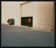
Culinary Union Election: Campaign Photos, Las Vegas (Nev.), 1990 (folder 1 of 1), image 15
Date
1990
Description
Arrangement note: Series III. Internal: Work
Image

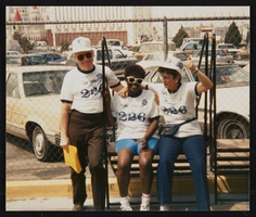
Culinary Union Election: Campaign Photos, Las Vegas (Nev.), 1990 (folder 1 of 1), image 16
Date
1990
Description
Arrangement note: Series III. Internal: Work
Image

Culinary Union Election: Campaign Photos, Las Vegas (Nev.), 1990 (folder 1 of 1), image 17
Date
1990
Description
Arrangement note: Series III. Internal: Work
Image
Culinary Union Election: Campaign Photos, Las Vegas (Nev.), 1990 (folder 1 of 1), image 18
Date
1990
Description
Arrangement note: Series III. Internal: Work
Image
Culinary Union Election: Campaign Photos, Las Vegas (Nev.), 1990 (folder 1 of 1), image 19
Date
1990
Description
Arrangement note: Series III. Internal: Work
Image

Culinary Union Election: Campaign Photos, Las Vegas (Nev.), 1990 (folder 1 of 1), image 20
Date
1990
Description
Arrangement note: Series III. Internal: Work
Image

Culinary Union Election: Campaign Photos, Las Vegas (Nev.), 1990 (folder 1 of 1), image 21
Date
1990
Description
Arrangement note: Series III. Internal: Work
Image

Culinary Union Election: Campaign Photos, Las Vegas (Nev.), 1990 (folder 1 of 1), image 22
Date
1990
Description
Arrangement note: Series III. Internal: Work
Image

Culinary Union Election: Campaign Photos, Las Vegas (Nev.), 1990 (folder 1 of 1), image 23
Date
1990
Description
Arrangement note: Series III. Internal: Work
Image

Culinary Union Election: Campaign Photos, Las Vegas (Nev.), 1990 (folder 1 of 1), image 24
Date
1990
Description
Arrangement note: Series III. Internal: Work
Image