Search Results
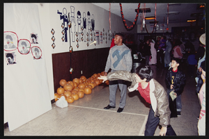
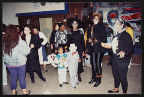
Halloween Party, Culinary Union, Las Vegas (Nev.), 1992 October (folder 1 of 1), image 6
Date
1992-10
Description
Arrangement note: Series IV. Internal: Social
Image

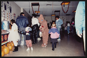
Halloween Party, Culinary Union, Las Vegas (Nev.), 1992 October (folder 1 of 1), image 7
Date
1992-10
Description
Arrangement note: Series IV. Internal: Social
Image

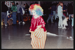
Halloween Party, Culinary Union, Las Vegas (Nev.), 1992 October (folder 1 of 1), image 8
Date
1992-10
Description
Arrangement note: Series IV. Internal: Social
Image
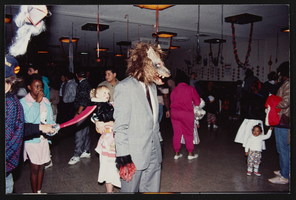
Halloween Party, Culinary Union, Las Vegas (Nev.), 1992 October (folder 1 of 1), image 9
Date
1992-10
Description
Arrangement note: Series IV. Internal: Social
Image
Halloween Party, Culinary Union, Las Vegas (Nev.), 1992 October (folder 1 of 1), image 10
Date
1992-10
Description
Arrangement note: Series IV. Internal: Social
Image

Halloween Party, Culinary Union, Las Vegas (Nev.), 1992 October (folder 1 of 1), image 11
Date
1992-10
Description
Arrangement note: Series IV. Internal: Social
Image
Halloween Party, Culinary Union, Las Vegas (Nev.), 1992 October (folder 1 of 1), image 12
Date
1992-10
Description
Arrangement note: Series IV. Internal: Social
Image
Halloween Party, Culinary Union, Las Vegas (Nev.), 1992 October (folder 1 of 1), image 13
Date
1992-10
Description
Arrangement note: Series IV. Internal: Social
Image

Halloween Party, Culinary Union, Las Vegas (Nev.), 1992 October (folder 1 of 1), image 14
Date
1992-10
Description
Arrangement note: Series IV. Internal: Social
Image

Halloween Party, Culinary Union, Las Vegas (Nev.), 1992 October (folder 1 of 1), image 15
Date
1992-10
Description
Arrangement note: Series IV. Internal: Social
Image