Search Results
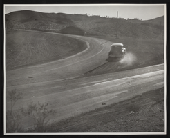
Photograph of the East Wye separating road, Boulder City, Nevada, circa 1935
Date
Archival Collection
Description
Image
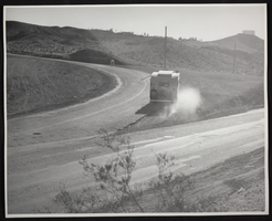
Photograph of the East Wye separating road, Boulder City, Nevada, circa 1935
Date
Archival Collection
Description
Image
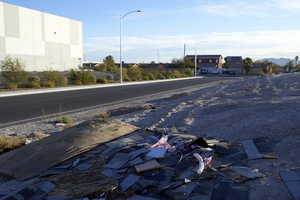
Trash sits dumped along East Branson Avenue, looking east, in an industrial and single family home neighborhood of North Las Vegas, Nevada: digital photograph
Date
Archival Collection
Description
From the UNLV University Libraries Photographs of the Development of the Las Vegas Valley, Nevada (PH-00394). Part of the collection documents the entire 19 mile length of the north/south Eastern Avenue / Civic Center Drive alignment. This photograph was captured in the section of Civic Center Drive between Alexander Road and Cheyenne Avenue.
Image
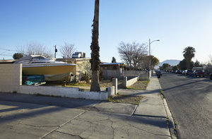
A boat sits in the driveway of a home on East Webb Avenue near Civic Center Drive, looking east-northeast in North Las Vegas, Nevada: digital photograph
Date
Archival Collection
Description
From the UNLV University Libraries Photographs of the Development of the Las Vegas Valley, Nevada (PH-00394). Part of the collection documents the entire 19 mile length of the north/south Eastern Avenue / Civic Center Drive alignment. This photograph was captured in the section of Civic Center Drive and Eastern Avenue between Lake Mead Boulevard and Washington Avenue.
Image
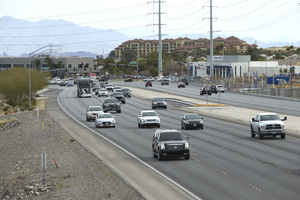
Traffic flows on St. Rose Parkway as seen from the Amargosa Pedestrian Bridge, east of Eastern Avenue, looking east-southeast in Henderson, Nevada: digital photograph
Date
Archival Collection
Description
From the UNLV University Libraries Photographs of the Development of the Las Vegas Valley, Nevada (PH-00394). Part of the collection documents the entire 19 mile length of the north/south Eastern Avenue / Civic Center Drive alignment. This photograph was captured in the section of Eastern Avenue between Silverado Ranch Boulevard and Coronado Center Drive.
Image
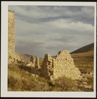
View of mill ruins east of Hamilton, Nevada: photographic print
Date
Description
Image
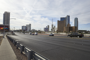
East Sahara Avenue, Las Vegas, Nevada: digital photograph
Date
Archival Collection
Description
Image
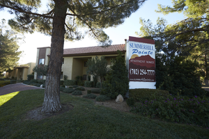
Summerhill Pointe Apartments sign, looking east, Las Vegas, Nevada: digital photograph
Date
Archival Collection
Description
Image
East Dillon, Union Securities and Company: financial records, 1946
Level of Description
Archival Collection
Collection Name: Julius Jensen Professional Papers
Box/Folder: Box 01
Archival Component
Las Vegas Convention Center: East Hall expansion, 1981
Level of Description
Archival Collection
Collection Name: J. A. Tiberti Construction Records
Box/Folder: Box 008
Archival Component