Search the Special Collections and Archives Portal
Search Results

Artist's conception of interior dance floor of Krave Massive at Neonopolis, 450 East Fremont Street, Las Vegas, Nevada: digital image
Date
Archival Collection
Description
Image
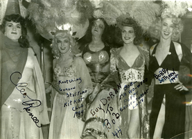
Cleo Renee, Gordon Stafford, Guy Doran, Poppy Lane, and Bobby Sothern at the Kit Kat Club, located at 2501 East Charleston Boulevard, Las Vegas, Nevada: digital image
Date
Archival Collection
Description
Image
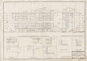
Architectural drawing of hi-rise addition, Sahara Hotel (Las Vegas), elevations (north and east) and exterior details, April 24, 1959
Date
Archival Collection
Description
Elevations and details for the addition of a hotel tower for the Sahara from 1959. Printed on onion skin.
Site Name: Sahara Hotel and Casino
Address: 2535 Las Vegas Boulevard South
Image
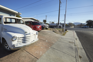
A vintage truck is parked at 2405 East Jansen Avenue near Eastern Avenue, looking northeast in Las Vegas, Nevada: digital photograph
Date
Archival Collection
Description
From the UNLV University Libraries Photographs of the Development of the Las Vegas Valley, Nevada (PH-00394). Part of the collection documents the entire 19 mile length of the north/south Eastern Avenue / Civic Center Drive alignment. This photograph was captured in the section of Civic Center Drive and Eastern Avenue between Lake Mead Boulevard and Washington Avenue.
Image
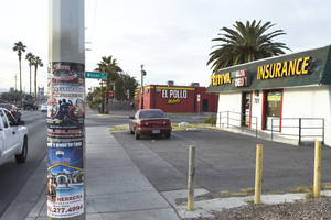
Spanish language advertising signs in the area of Eastern Avenue and East Wilson Avenue, looking south in Las Vegas, Nevada: digital photograph
Date
Archival Collection
Description
From the UNLV University Libraries Photographs of the Development of the Las Vegas Valley, Nevada (PH-00394). Part of the collection documents the entire 19 mile length of the north/south Eastern Avenue / Civic Center Drive alignment. This photograph was captured in the section of Eastern Avenue between Washington and Stewart Avenues.
Image
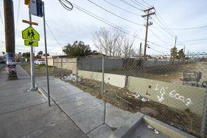
A utility corridor is seen off Eastern Avenue near East McWilliams Avenue, looking southwest in Las Vegas, Nevada: digital photograph
Date
Archival Collection
Description
From the UNLV University Libraries Photographs of the Development of the Las Vegas Valley, Nevada (PH-00394). Part of the collection documents the entire 19 mile length of the north/south Eastern Avenue / Civic Center Drive alignment. This photograph was captured in the section of Eastern Avenue between Washington and Stewart Avenues.
Image
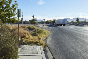
Looking northeast, a semi truck travels on East Gowan Road toward residential areas in North Las Vegas, Nevada: digital photograph
Date
Archival Collection
Description
From the UNLV University Libraries Photographs of the Development of the Las Vegas Valley, Nevada (PH-00394). Part of the collection documents the entire 19 mile length of the north/south Eastern Avenue / Civic Center Drive alignment. This photograph was captured in the section of Civic Center Drive between Alexander Road and Cheyenne Avenue.
Image
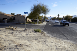
Looking northeast at a single family housing on North Berg Street at East Gowan Road in North Las Vegas, Nevada: digital photograph
Date
Archival Collection
Description
From the UNLV University Libraries Photographs of the Development of the Las Vegas Valley, Nevada (PH-00394). Part of the collection documents the entire 19 mile length of the north/south Eastern Avenue / Civic Center Drive alignment. This photograph was captured in the section of Civic Center Drive between Alexander Road and Cheyenne Avenue.
Image
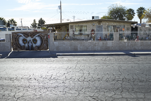
A mid-century modern house on East Brooks Avenue near Civic Center Drive in North Las Vegas, Nevada: digital photograph
Date
Archival Collection
Description
From the UNLV University Libraries Photographs of the Development of the Las Vegas Valley, Nevada (PH-00394). Part of the collection documents the entire 19 mile length of the north/south Eastern Avenue / Civic Center Drive alignment. This photograph was captured in the section of Civic Center Drive between Cheyenne Avenue and Las Vegas Boulevard.
Image
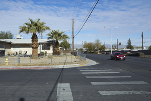
A single family home looking north at Civic Center Drive and East Cartier Avenue in North Las Vegas, Nevada: digital photograph
Date
Archival Collection
Description
From the UNLV University Libraries Photographs of the Development of the Las Vegas Valley, Nevada (PH-00394). Part of the collection documents the entire 19 mile length of the north/south Eastern Avenue / Civic Center Drive alignment. This photograph was captured in the section of Civic Center Drive between Cheyenne Avenue and Las Vegas Boulevard.
Image
