Search the Special Collections and Archives Portal
Search Results
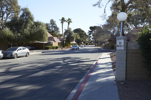
Paradise Valley Way as seen from Eastern Avenue, looking east-northeast in Las Vegas, Nevada: digital photograph
Date
Archival Collection
Description
From the UNLV University Libraries Photographs of the Development of the Las Vegas Valley, Nevada (PH-00394). Part of the collection documents the entire 19 mile length of the north/south Eastern Avenue / Civic Center Drive alignment. This photograph was captured in the section of Eastern Avenue between Tropicana Avenue and Russell Road.
Image
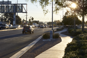
Traffic flows on Russell Road near Eastern Avenue, looking east-northeast in Las Vegas, Nevada: digital photograph
Date
Archival Collection
Description
From the UNLV University Libraries Photographs of the Development of the Las Vegas Valley, Nevada (PH-00394). Part of the collection documents the entire 19 mile length of the north/south Eastern Avenue / Civic Center Drive alignment. This photograph was captured in the section of Eastern Avenue between Russell and Sunset Roads.
Image
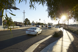
Traffic flows on Russell Road near Eastern Avenue, looking east-northeast in Las Vegas, Nevada: digital photograph
Date
Archival Collection
Description
From the UNLV University Libraries Photographs of the Development of the Las Vegas Valley, Nevada (PH-00394). Part of the collection documents the entire 19 mile length of the north/south Eastern Avenue / Civic Center Drive alignment. This photograph was captured in the section of Eastern Avenue between Russell and Sunset Roads.
Image
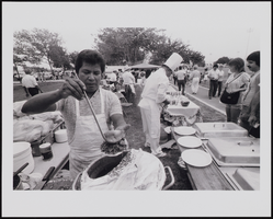
Cinco De Mayo celebration organized by Eddie Escobedo Sr. and the Mexican Patriotic Committee at Freedom Park, East Las Vegas, Nevada: photographic print
Date
Archival Collection
Description
May 5th is one of the holidays most celebrated in Mexico. The day commemorates a famous victory by Mexico over the French in the Battle of Puebla. The Mexicans were victorious despite overwhelming odds favoring the French. Shown is a photograph of the annual fiesta put on each year at Freedom Park in East Las Vegas by Eddie Escobedo Sr. and the Mexican Patriotic Committee.
Image
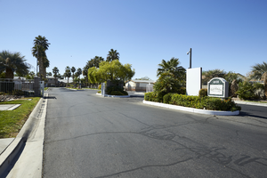
Sunrise Gardens Mobile Home Park entrance off East Sahara Avenue west of Tree Line Drive, looking south, Las Vegas, Nevada: digital photograph
Date
Archival Collection
Description
Image
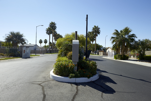
Sunrise Gardens Mobile Home Park entrance off East Sahara Avenue west of Tree Line Drive, looking south, Las Vegas, Nevada: digital photograph
Date
Archival Collection
Description
Image
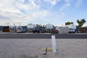
Trailers and lots in the he Maycliff RV & Mini Storage Park on East Sahara Avenue west of Lamb Boulevard, looking south, Las Vegas, Nevada: digital photograph
Date
Archival Collection
Description
Image
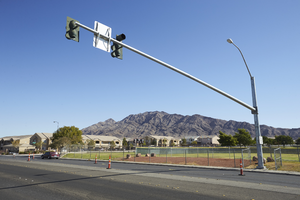
Traffic light for Las Vegas High School on Tree Line Drive north of East Sahara Avenue, looking northeast, Las Vegas, Nevada: digital photograph
Date
Archival Collection
Description
Image
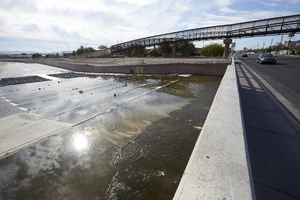
Flamingo Arroyo Trail system bridge and Flamingo Wash cross Lamb Boulevard south of East Sahara Avenue, looking southeast, Las Vegas, Nevada: digital photograph
Date
Archival Collection
Description
Image
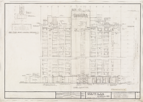
Architectural drawing of Sahara Hotel 400 hi-rise addition (Las Vegas), east elevation, December 29, 1961
Date
Archival Collection
Description
Architectural plans for the addition of a hotel tower for the Sahara from 1961. Includes revisions and sign tower detail. Printed on onion skin. Leon Gluckson, architect; Berton Charles Severson, architect.
Site Name: Sahara Hotel and Casino
Address: 2535 Las Vegas Boulevard South
Image
