Search Results
T-Shirt Color: Gray; Front: East Haven Firefighters Local 1205, Local Union Emblem; Handwritten Text: God Bless All Of The Fallen , East Haven CT. 14, Feb. 2002, approximately 2001-2012
Level of Description
Archival Collection
Collection Name: New York-New York Hotel and Casino 9-11 Heroes Tribute Collection
Box/Folder: Box 343
Archival Component
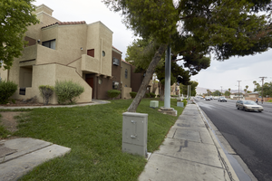
Grass landscaping at the Pacific Harbors Sunrise Apartments on East Sahara Avenue near Nellis Boulevard, Clark County, Nevada: digital photograph
Date
Archival Collection
Description
Image
Grass landscaping at the Pacific Harbors Sunrise Apartments on East Sahara Avenue near Nellis Boulevard, Clark County, Nevada: digital photograph
Date
Archival Collection
Description
Image
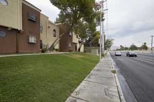
Grass landscaping at the Pacific Harbors Sunrise Apartments on East Sahara Avenue near Nellis Boulevard, Clark County, Nevada: digital photograph
Date
Archival Collection
Description
Image
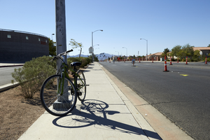
Bicycle on Tree Line Drive north of East Sahara Avenue, looking south, Las Vegas, Nevada: digital photograph
Date
Archival Collection
Description
Image
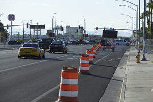
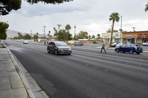
Traffic barrels on Fremont Street near East Sahara Avenue looking southeast, Las Vegas, Nevada: digital photograph
Date
Archival Collection
Description
Image
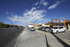
Sahara Auto on East Sahara Avenue near Chapman Drive looking west, Las Vegas, Nevada: digital photograph
Date
Archival Collection
Description
Image

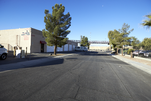
Business on South Santa Clara Drive at East Sahara Avenue looking south, Las Vegas, Nevada: digital photograph
Date
Archival Collection
Description
Image
Industrial businesses on East Gowan Road in North Las Vegas, Nevada: digital photograph
Date
Archival Collection
Description
From the UNLV University Libraries Photographs of the Development of the Las Vegas Valley, Nevada (PH-00394). Part of the collection documents the entire 19 mile length of the north/south Eastern Avenue / Civic Center Drive alignment. This photograph was captured in the section of Civic Center Drive between Alexander Road and Cheyenne Avenue.
Image
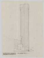
Architectural drawing, Riviera Hotel and Casino (Las Vegas), Riviera tower east elevation, December 21, 1981
Date
Archival Collection
Description
East elevation of the proposed Riviera tower, rendered by RR. Original material: tracing paper.
Site Name: Riviera Hotel and Casino
Address: 2901 Las Vegas Boulevard South
Image