Search Results
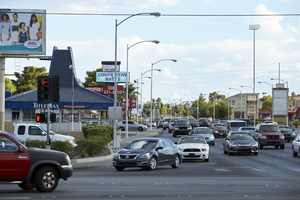
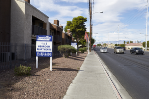
Traffic on South Eastern Avenue at East Sahara Avenue looking north, Las Vegas, Nevada: digital photograph
Date
Archival Collection
Description
Image
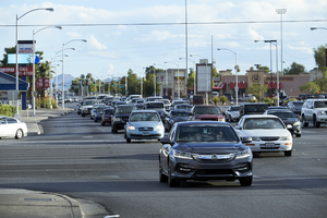
Traffic on South Eastern Avenue at East Sahara Avenue looking north, Las Vegas, Nevada: digital photograph
Date
Archival Collection
Description
Image
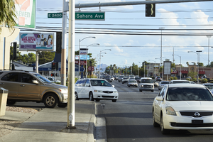
Traffic on South Eastern Avenue at East Sahara Avenue looking north, Las Vegas, Nevada: digital photograph
Date
Archival Collection
Description
Image
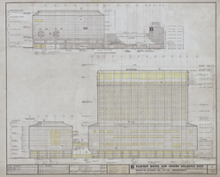
Architectural drawing of the Playboy Hotel and Casino (Atlantic City), south and east elevations, April 5, 1979
Date
Archival Collection
Description
South and east elevations for the construction of the Playboy Hotel and Casino. Includes revision dates. Original material: mylar. Drawn by: Jerry C. Project Architect: Fred Anderson Job Captain: Bobby C.
Site Name: Playboy Hotel and Casino (Atlantic City)
Address: Florida Ave & Boardwalk, Atlantic City, NJ
Image
A single family neighborhood as seen from the Amargosa Pedestrian Bridge over St. Rose Parkway, east of Eastern Avenue, looking east-southeast in Henderson, Nevada: digital photograph, 2019 March 28
Level of Description
Archival Collection
Collection Name: UNLV University Libraries Photographs of the Development of the Las Vegas Valley, Nevada
Box/Folder: N/A
Archival Component
The St. Rose Parkway corridor as seen from the Amargosa Pedestrian Bridge on St. Rose Parkway, east of Eastern Avenue, looking east-northeast in Henderson, Nevada: digital photograph, 2019 March 28
Level of Description
Archival Collection
Collection Name: UNLV University Libraries Photographs of the Development of the Las Vegas Valley, Nevada
Box/Folder: N/A
Archival Component
The St. Rose Parkway corridor as seen from the Amargosa Pedestrian Bridge on St. Rose Parkway, east of Eastern Avenue, looking east-southeast in Henderson, Nevada: digital photograph, 2019 March 28
Level of Description
Archival Collection
Collection Name: UNLV University Libraries Photographs of the Development of the Las Vegas Valley, Nevada
Box/Folder: N/A
Archival Component

Aerial photograph of Las Vegas, looking east down Fremont Street, circa late 1940s
Date
Archival Collection
Description
Aerial view of Las Vegas, looking east down Fremont Street. Jackie Gaughan's Plaza was originally named Union Plaza and is currently called the Plaza Hotel and Casino.
Transcribed Notes: Transcribed from back of photo: "Fremont Street in downtown Las Vegas as it appeared in the late 1940s. In the foreground stands the Union Pacific Depot where Jackie Gaughan's Plaza stands today."
Image
Traffic on East Sahara Avenue west of Nellis Boulevard, looking west, Las Vegas, Nevada: digital photograph
Date
Archival Collection
Description
Image
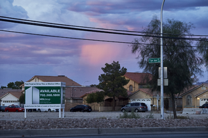
Vacant land off East Sahara Avenue looking northeast at dusk, Las Vegas, Nevada: digital photograph
Date
Archival Collection
Description
Image